Explore the best places
Outdoor activities in São Roque do Pico
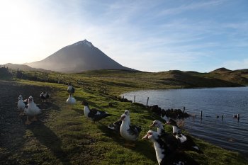
Trilho Pedestre da Lagoa do Capitão (PR13)
- country
Estrada Longitudinal - ER3-2
9940, São Roque do Pico
This route begins next to Lagoa do Capitão, located on the central plateau in the interior of Pico Island. The first part of the trail is followed on a dirt track until reaching Cabeço do Piquinho. Here you get a wonderful view of the north coast of Pico island, highlighting the final destination of the walk, Cais do Pico.
Trilho Pedestre Santana - Lajido (PR10)
- country
Rua da Eira do Cabeço
9940, São Roque Do Pico
Route which begins down a path that goes up to the whale Lookout from where you can enjoy a privileged view over the canal and the island of São Jorge. Then go down to the Bay of Gasparal, which was used for many years as boarding zone for kites of verdelho wine to export. From this point the route always follows in the coastal area to the Lajido.
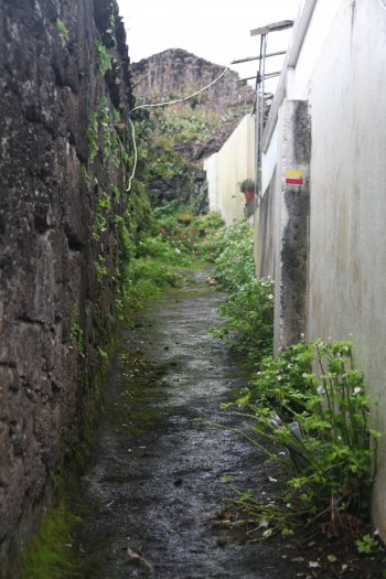
Trilho Pedestre da Ladeira dos Moinhos (PRC8)
- country
Rua das Dores
9940-347, São Roque do Pico
Small circular route that starts in the Centre of São Roque do Pico. Along the way are six watermills and an ancient stone threshing floor, from which you can enjoy a panoramic view of the parish of São Roque.
Trilho Pedestre da Prainha do Norte (PRC9)
- country
Rua do Senhor
9940, São Roque do Pico
This small circular route starts and ends in the central Garden of Prainha do Norte. Right at the beginning the trail passes through small agricultural fields until the path of Ribeira de Nossa Senhora, a cluster of houses, many of them abandoned, located across the river that accompanies the path. After the route is developed along the coast, passing through the sand Bay, the only sandy beach of the island.
Trilho Pedestre do Caminho de Burros: Vertente Norte (PR2)
- country
São Miguel Arcanjo
9940, São Roque do Pico
Pedestrian path that crosses the island of Pico of the North coast to the South coast. It begins in the Central Plateau of the peak and has two variants, one that ends in the Bay of Canas and another in São Miguel Arcanjo. The section for St. Michael the Archangel is always on dirt. If you choose for the Bay of Canas will continue on the dirt floor to find a path to the left that follows through a thicket of Acacia trees and laurels. This road ends at Parque Florestal da Prainha and walking along the Park is a …
Trilho Pedestre dos Caminhos de Santa Luzia (PR1)
- country
Santa Luzia
9950, Madalena
Route which starts descending towards the sea by a route that crosses the culture landscape of vineyards, a Unesco World Heritage site, until the Lajido. Here it is worth visiting the Museum and also observe the various geological formations existing in the site. The path continues then uphill, passing through the Furnace of Friars ending in the Church of Santa Luzia.