Explore the best places
Outdoor activities in Nisa
Percurso Pedestre Olhar sobre a Foz (PR3)
- country
São Matias
6050, São Matias
Walking route of 5.75 kilometers and expected to last 2 hours. It begins at the Velada Hydroelectric Power Station, built in 1935; it runs alongside Ribeira de Nisa. After passing the point where it crosses the Tagus, the most difficult point of the route is reached, as the eucalyptus trees become denser and the climb is steep, but it will be worth the effort, as, at the top, there will be an incredible panoramic view over the Nisa and the Tagus. The difficulty level of this tour is easy.
Percurso Pedestre Trilhos do Moinho Branco (PR8)
- country
Montalvão
6050, Montalvão
Another route beginning on passing the river and Masroor Sever. Until you reach the White Mill there are many points of interest, whether natural or architectural, along 14 miles of road. The shale predominates. At this point the route stop to rest and refresh themselves on "the lizard". The envisaged duration is 4:0.
Percurso Pedestre Trilho do Conhal (PR4)
- country
Rua Nova
6050, Santana
First of all, be aware that the Conhal is a heap extensive formed by pebbles that are piled up. This route starts at the average difficulty Arneiro and goes towards the serra de s. Miguel. Along 9.8 kilometers of road will find tree species and protected bird. There will be a moment that will pass the Conhal and may rise by pebbles. Meet community ovens and houses full of typical elements. The duration is 3:30 h.
Percurso Pedestre Trilho das Jans (PR1)
- country
Rua do Matadouro
6050, Amieira do Tejo
Pedestrian path with the extension of 12.6 kilometres and the duration of 3:30 h. The richness of this course is on diversity of vegetation, which provides panoramic views at strategic points along the route, and on avifauna inhabiting the margins of the Tagus River. The castle of Amieira and ribeira da Maia are also included in this route of average difficulty.
Percurso Pedestre Rota dos Açudes (PR6)
- country
EM 526
6050, Montalvão
Beginning in the village of Salavessa, filled with typical houses, this route will be taken down the Tagus till you find a pontoon to the water edge you will get to a dam and the bowels of serra de São Miguel. In your company will be the ribeira de Fivelo, where another dam, behind which come. The extent of this ride is 10.6 km and estimated duration of the 3:30 h.
Percurso Pedestre Entre Azenhas (PR7)
- country
Montalvão
6050, Montalvão
Pedestrian path with 6.5 miles long and anticipated length of 2:30 h. Starts at Masroor, where there is no shortage of monuments of historical and cultural interest to visit. Follows the threshing floor of Finn through Rails and steep slopes leading to the banks of the river Sever which borders Spain. Pay attention to the ruins of shale.
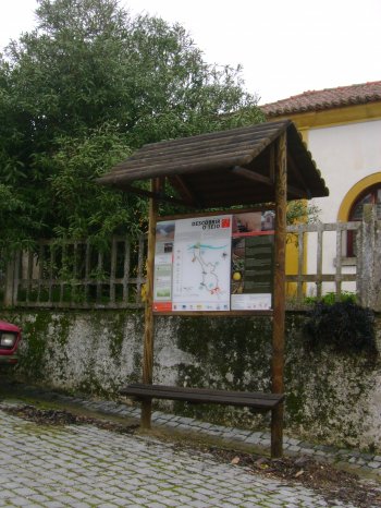
Percurso Pedestre Descobrir o Tejo (PR2)
- country
Rua Principal
6050, São Matias
As its name indicates, this route will take you to learn a little more about the South Bank of the Tagus. It's an easy ride because they're just 4.25 kilometers and 1:30 walking. Begins in elementary school of Old floor. Wake-up call to Alentejo fireplaces. The route follows the path of Woods, trails and narrow paths; rest in the Park picnic and admire the river and the different species of birds reside here.
Percurso Pedestre à descoberta de São Miguel (PR5)
- country
Pé da Serra
6050, São Simão
With this course you will learn more about the Sierra de s. Miguel and what this guard. Starts at the Foot of the Sierra (where should visit the Chiesa Madre (mother church) and the type of houses), takes place in several natural viewpoints and the gastronomy is proof required. Drink some water in Vinagra sources and look at the chimneys of the houses. An estimated 3:0 are sufficient to make a route of 9.2 kilometers.