Explore the best places
Monuments in Montalegre
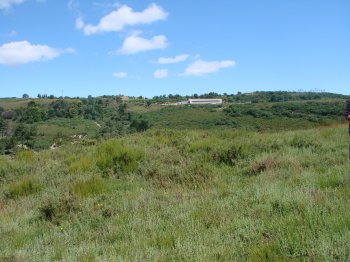
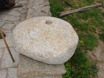
Mamoa 1 de Chã de Casteleira
- heritage
Chã de Casteleira
5470-480, Solveira
Megalithic monument quite destroyed, with difficult visibility in the landscape, located about five meters from the county road that connects Montalegre to keys. Do not identify any props, although evident the remains of lytic Cuirass.
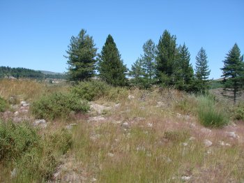
Mamoa 1 de Castro
- heritage
Solveira
5470-480, Solveira
Possible megalithic monument located about 150 metres from the castro de Serraquinhos. Is partially cut off by a path, not presenting central depression, common in most of these monuments, but checking if remains of lytic Cuirass.
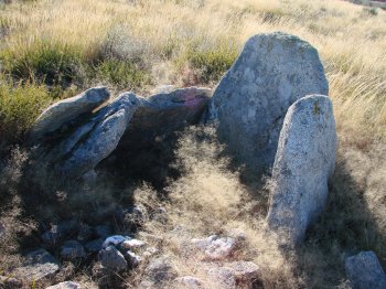
Mamoa de Cabanas
- heritage
Pedrário
5470-465, Sarraquinhos
Tumulus about 8.5 m maximum diameter, features plated remains and lithic tumuli reasonably visible, a result of the great depression. The Chamber there are six Struts that outcrop at the surface, some of them to about half a meter. The mainstay which looks as if it belonged at the head emerges over one meter. The tumulus is located in a small ground, on the right side of the road that connects Pedrário to Meixide, along a seam of Quartz. This is a great example of how visible would be the construction of a tapir.
Mamoa 2 do Penedo da Caldeira
- heritage
Vila da Ponte
5470-543, Vila da Ponte
Megalithic Tomb monument located about 20 yards north of a high voltage Pole on the ribeira da Cambela. It is a large monument, with a "tumuli" with about fifteen meters in diameter and three feet tall. On the surface are several petroleum elements that belong to the breastplate and a shallow depression which identify some props.
Mamoa 1 do Penedo da Caldeira
- heritage
Vila da Ponte
5470-543, Vila da Ponte
Megalithic funerary monument located on a hill overlooking the ribeira da Cambela. It is a large tumulus, about eleven metres, easy visibility in the landscape. Presents a "tumuli" high, a central depression very sharp, an extensive lytic armour and a retaining ring, not being visible traces of dolmen.
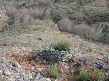
Castro da Mina
- heritage
Vilar de Perdizes
5470-461, Vilar de Perdizes
Fortified settlement already, located on the left bank of the Açoreira River, amounting to a maximum altitude of 736 metres. Has two imposing concentric walls, complementing the defense with a pit carved into the rock and with a turret. On the East side, there is still one of the entries in the second line of wall, with approximately 2.70 metres wide. The walls are built in appliance pseudoisódomo, observing in some sections both sides. Inside the enclosure, to the surface, ceramic fragments were found Castro home. Due to the absence of datable material of time later, it is believed that …
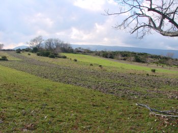
Povoado de Pardelhas
- heritage
Vilar de Perdizes
5470, Vilar de Perdizes
Prehistoric settlement, with continuous occupation until the Roman era, located between the rivers of King Harbor and Assureira, 772 metres above sea level, along the road that connects Vilar de Perdizes in the chapel of Santa Marinha, on the north side. Dominates part of the Valley, from the village of Vilar de Perdizes Assureira to rio. On the slopes, on the north side, alignments are visible walls. On the upper deck and small slopes there are remains of old buildings. To the South, Southeast and West of the fortified enclosure are domestic pottery shards and the construction of Roman typology, …
Povoado da Veiga
- heritage
Vilar de Perdizes
5470, Vilar de Perdizes
Possible Roman settlement, located on farmland to the South and East of State Highway 508, between the chapel of our Lady of health and the village of Vilar de Perdizes. Here, on the riverbank Assureira, are fragments of "tegullae", Roman and domestic pottery stones fond. In some places displays alignments also walls. Given the scope of this possible settlement, it is considered to have been an important habitat of the Roman era that, due to the absence of later materials, suggests being abandoned.
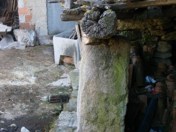
Gravura na Rua do Alvar
- heritage
Rua do Alvar
5470-461, Vilar de Perdizes
Granite pole located in the inner courtyard of a private house, which supports a balcony in ruins. The post presents a rectangular shape, having recorded on one side three concentric circles, which can be interpreted as solar motifs. This engraving is identical to that found in deer, near the tumulus of Tojais.
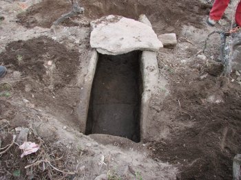
Sepultura de Vilar de Perdizes
- heritage
Vilar de Perdizes
5470-460, Vilar de Perdizes
Cave grave located in a vineyard, adjacent to the wall of the churchyard of the parish church of St. Michael. Presents 1.70 meters long, 0.55 meters and 0.50 meters wide. It is a burial grave, consisting of two side slabs, a nightstand and another cover, match, which currently are based in lajeado Fund.