Explore the best places
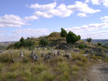
Castro de Vilarinho dos Galegos
- heritage
Vilarinho dos Galegos
5200-572, Mogadouro
Castro dating from the Iron Age, located on a cliff above the Douro River, a difficult-to-access location, chosen because it has good natural defenses. The defenses were reinforced with a field of set stones, a moat, a turret and a line of walls. Here you can find rare fauna, from the Bonelli eagle, to the black stork and the Egyptian vulture.
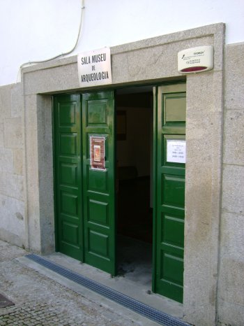
Sala Museu de Arqueologia de Mogadouro
- heritage
Rua Dom Afonso II
5200-241, Mogadouro
This museum is made up of archaeological pieces found in the municipality, the result of archaeological excavations and surface remains, some of which are rare, both nationally and on the peninsular level.
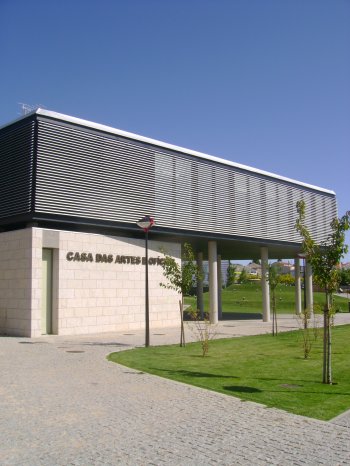
Casa das Artes e Ofícios
- art
Avenida dos Comandos
5200-206, Mogadouro
Located in Parque da Vila, this modern space hosts various activities and workshops, such as ballroom dancing classes, music, painting, aerobics, among others. It also includes an exhibition space and the Municipal Tourism Office.
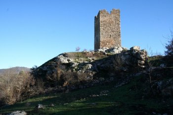
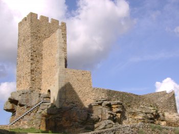
Castelo de Penas Róias
- heritage
Penas Roias
5200-311, Mogadouro
A short distance from the village of Penas Roias are the remains of this castle with a quadrangular structure. All that remains of the castle is the keep, the remains of a circular cube and some sections of the wall. This castle provided the first line of defense in the northeast of Trás-os-Montes, together with the castles of Algoso, Miranda do Douro, Outeiro, Vimioso and Mogadouro, with which it formed a strong defensive group.
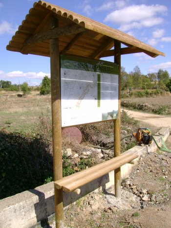
Trilho do Azeite
- country
Rua do Abecheiro
5200-090, Mogadouro
Short walking route, suitable for walking or driving, integrated into the Douro International Park. With a length of around nine kilometers, it takes four hours on foot and one hour by car. It begins and ends at the Rural Interpretation Center, in the village of Bruçó, following paths through olive groves, among the cliffs of the Douro River. At the end of the trail, you can visit the traditional olive oil press, in the same village.
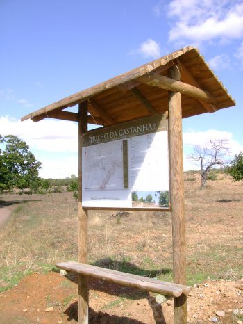
Trilho da Castanha
- country
Bruçó
5200-090, Mogadouro
Short route, intended to be done on foot or by 4X4, with a length of around eleven kilometers. It takes five hours on foot or an hour and a half in a 4X4. It starts and ends at the Rural Interpretation Center in the village of Bruçó (where you can purchase products made with chestnuts), traveling through land occupied by chestnut trees, with emphasis on a century-old chestnut tree.
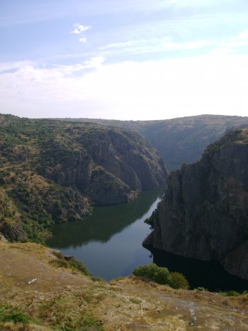
Parque Natural do Douro Internacional
- country
Rua Dr. Francisco António Vicente, 4
5200-241, Mogadouro
Integrating the municipalities of Figueira de Castelo Rodrigo, Freixo de Espada-à-Cinta, Miranda do Douro and Mogadouro, the Douro Internacional Natural Park covers the 122 kilometers of border section of the Douro River and extends south, to the Douro Valley. From a very deep valley and two plateau areas (essentially granite), one to the North with altitudes of around 700-800 meters and the other to the South with altitudes of around 600-700 meters. The gorges carved by the Douro and Águeda rivers are extremely deep (up to 200 meters) and of great beauty. The Park reaches its maximum altitude (895 meters) …
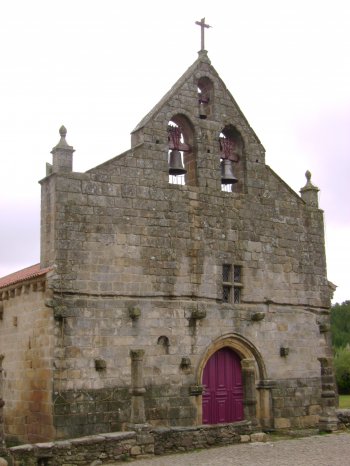
Igreja Matriz de Santa Maria de Azinhoso
- heritage
Rua do Passo
5200-010, Mogadouro
It is a Gothic temple with a Romanesque design, whose foundation is attributed to the Templars, with a longitudinal plan, consisting of a single nave and a porch on the gospel side, where the Romanesque door stands out on the opposite elevation. Highlight the enormous diversity of dog motifs and the central framing of the bell tower with three windows.
Castelo de Mogadouro
- heritage
Rua João de Freitas, 32
5200-277, Mogadouro
The castle of Mogadouro was donated by D. Afonso Henriques to the Templars and, a few years later, passed to the Order of Christ, its successor. Today, only two sections of walls remain, an isolated tower with rectangular faces and some scarce remains of carved walls.
Barragem de Belver
- beach
- country
Belver
6040, Belver
Dam belonging to the Tagus river basin, whose construction ended in 1952. It is 30 meters high and is used to supply energy.