Explore the best places
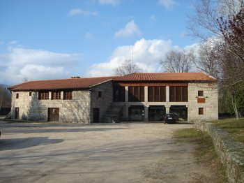
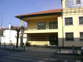
Museu Regional de Arqueologia e Etnografia de Arganil
- heritage
Avenida das Forças Armadas
3300-011, Arganil
The Regional Museum of Archaeology and Ethnography of Arganil encompasses the collection from the Roman military camp of Lomba do Canha (2nd century, Republican period) and dolmens 1 and 2 of Moinhos de Vento, Lomba do Canha, Arganil.
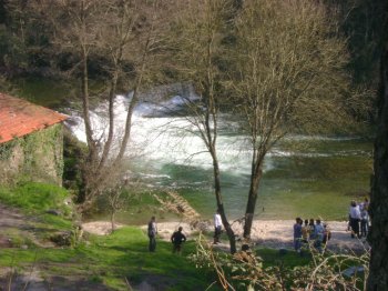
Praia Fluvial dos Moinhos de Alva
- beach
Praia Fluvial dos Moinhos de Alva
3305, Coja
A bathing area located on the Alva River, very pleasant for a hot day.
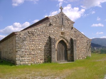
Capela de São Pedro
- heritage
Rua Comendador Saúl Brandão - EN342-4
3300, Arganil
A granite temple dating from the 13th century (a period of transition from Romanesque to Gothic). The interior has three identical naves and apsidal chapels.
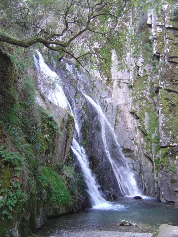
Queda de Água da Fraga da Pena
- beach
- country
Fraga da Pena
3305, Benfeita
Located within the Serra do Açor Protected Landscape Area, near the village of Benfeita, Fraga da Pena is a kind of miniature replica of Poço do Inferno in the Serra da Estrela mountain range. As the waters of the Barroca das Degrainhas stream flow towards the Ribeira da Mata stream, they encounter a drop of more than 20 meters, forming a waterfall and, below, a small lagoon. The rock formation is entirely covered in moss and surrounded by vegetation. The temperature there, even in summer, is extraordinarily low.
Paisagem Protegida da Serra de Açor
- country
Estrada Panorâmica do Alto da Ceira
3305-034, Benfeita
The Serra do Açor, along with the Serra da Estrela and the Serra da Lousã, forms the group of mountain ranges that practically divide Portugal in half. Partly covered by pine forests, the mountain range, located within the municipality of Arganil, hides details of rare beauty. The Mata da Margaraça is an example of this scenic beauty, constituting one of the rare examples of natural vegetation on the schist slopes of the country's center. Species such as chestnut, oak, laurel, and some holly and laurel trees make up the flora of this protected landscape area. In terms of fauna, we …
Percurso Pedestre Socalcos - Relva Velha
- country
Relva Velha
3305, Moura da Serra
Interpretive circuit that is part of the Serra do Açor Protected Landscape Area. Starting and ending point is in Porto Cerejeiro. It is 1.6 km long and takes approximately 2 hours. Points of interest: Ribeira da Mata stream; view over the Mata da Margaraça forest; terraced fields; village of Relva Velha.
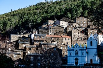
Aldeia de Piódão
- heritage
Largo Cónego Manuel Fernandes Nogueira
6285, Piódão
Designated a Property of Public Interest in 1978, the village of Piódão is located near the Hermínios Mountains and is one of the oldest settlements in the country, unique for its clustered layout surrounded by an extensive green expanse. The village originated from the need for concentration and settlement of shepherds who lived in the surrounding area. Its landscape and architectural ensemble is remarkable (with schist being the main material used in construction). Due to its difficult access, the village is known as a refuge for notorious criminals. Of particular note are the parish's four chapels: St. John, St. Barbara, …
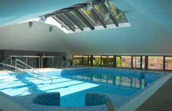
Termas & Spa do Gerês
- beach
- leisure
Avenida Manuel Francisco da Costa, 125
4845-069, Vilar da Veiga
These thermal baths are located in the heart of the Peneda-Gerês National Park, an area of extreme beauty with breathtaking lakes and mountains. Already known to the Romans, their exploitation resumed during the reign of King John V. In 1897, the original baths were demolished to make way for new buildings and water catchment. The waters are especially recommended for the treatment of liver and gallbladder problems, obesity, diabetes, and high blood pressure. They also offer programs for dietary re-education, weight loss, physical and psychological relaxation, physical recovery, and stress relief.
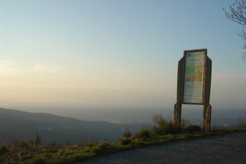
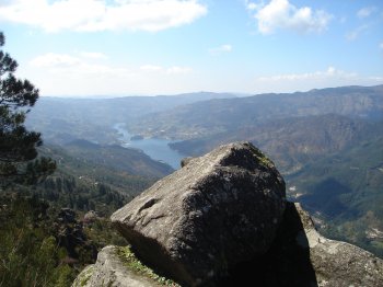
Miradouro Novo da Pedra Bela
- country
- leisure
Vilar da Veiga
4845, Gerês
Bring your camera because at this spot you can take photos of one of the most beautiful landscapes in the entire municipality and one of the most impressive in our country. Located at an altitude of 829 meters, from here you can see the entire Gerês valley and the Caniçada reservoir.
Porta do Parque Nacional do Gerês
- art
Estrada da Ponte Romana
4840-030, Campo do Gerês
The infrastructure located next to the Vilarinho das Furnas Museum is the ideal place to receive tourists and provide them with a wide range of information about the National Park, specifically what they can visit, thus becoming an Interpretive Center for the National Park. The space is composed of seven themed rooms, namely: “History of the Earth I and II” – describing the formation of the Serra Gaúcha; the “History of Rain” room, which portrays water and all biodiversity with emphasis on riparian vegetation; the “Forest Room”; the “Territory, Museum and Mountain” room, which addresses the occupation of the territory …