Explore the best places
Country in Portugal
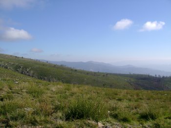
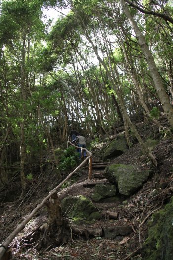
Serra da Freita
- country
Serra da Freita
3730, Arões
Serra da Freita is part of the Gralheira Massif, together with Serra da Arada and Serra do Arestal, reaching its maximum altitude at 1085 meters at Pico de São Pedro Velho, and extending through the municipalities of Arouca, São Pedro do South and Vale de Cambra. There you will find natural riches such as the Frecha da Mizarela waterfall, 75 m high, and the Pedras Parideiras, a geological phenomenon that can only be observed in Russia. These are a type of stones that are “born” from a mother rock of granite origin, and which symbolize fertility in the region’s popular …
Trilho Pedestre Serra Branca - Praia (PR1)
- country
Serra Branca
9880, Santa Cruz da Graciosa
This trail starts near the access to the Serra Branca Wind Farm, ending then in Praia. It crosses Graciosa Island from the west coast to the east coast, passing Pico das Caldeirinhas, the highest of the Serra Branca volcanic cones, measuring around 360 meters.
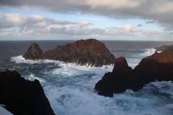
Ilhéu da Baleia
- country
Ponta da Barca
9880-303, Santa Cruz da Graciosa
This curious basalt formation of volcanic origin resembles, in profile, the shape of a whale, which gives it its name. It is located in the small bay of Ponta da Barca.
Trilho Pedestre Volta à Caldeira - Furna do Enxofre (PRC2)
- country
ER2-2
9880-205, Santa Cruz da Graciosa
This trail starts and ends next to Canada Longa, passing through Furna do Enxofre and Furna da Maria Encantada, where there is a viewpoint with superb views. After surrounding the Caldeira, it ends at Cana Longa.
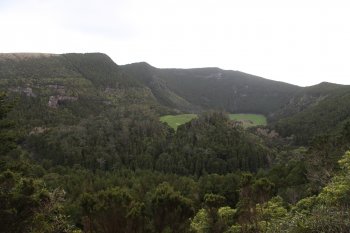
Caldeira
- country
Caldeira
9880-205, Santa Cruz da Graciosa
Classified as a Regional Natural Monument, this large crater is covered with vegetation, creating a broad green blanket of great natural beauty. Inside, we find Furna do Enxofre, one of the island's landmarks.
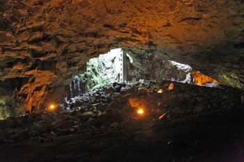
Furna do Enxofre
- country
Caldeira
9880-205, Santa Cruz da Graciosa
This geological phenomenon of great spectacularity and beauty is located inside Caldeira da Graciosa. This lava cave features a circular depression 1600 meters in diameter and 350 meters deep, in the place where the top of a volcano that gave rise to the island was previously located. At the bottom, there is a lake of cold, sulfurous water. The exploration of this cave began in the 19th century by several researchers, including Prince Albert of Monaco.
Trilho Pedestre da Lagoa do Capitão (PR13)
- country
Estrada Longitudinal - ER3-2
9940, São Roque do Pico
This route begins next to Lagoa do Capitão, located on the central plateau in the interior of Pico Island. The first part of the trail is followed on a dirt track until reaching Cabeço do Piquinho. Here you get a wonderful view of the north coast of Pico island, highlighting the final destination of the walk, Cais do Pico.
Paisagem Protegida do Lajido de Santa Luzia
- country
Lajido
9940-108, Madalena
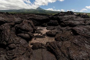
The Pico Island Vineyard Culture Landscape is made up of Lajido da Criação Velha and Lajido de Santa Luzia, occupying a total of 154 hectares. These sites constitute excellent representations of traditional architecture, landscape design and natural elements, located on extensive lava fields. Since 2004, the vineyard landscape on the island of Pico has been classified by UNESCO as a World Heritage Site.
Fumarolas - Caldeiras das Furnas
- country
Largo das Caldeiras
9675-045, Furnas
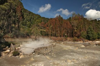
Set of fumaroles located in the center of the island, more specifically inside Caldeira das Furnas. Here you can find around twelve types of water, each with different medicinal properties.
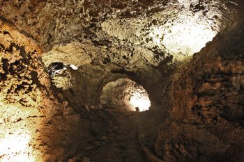
Gruta do Natal
- country
EM502
9760, Praia da Vitória
Large geological formation with branches in different tunnels, formed by lava that flowed in different directions. It is located within the Serra de Santa Bárbara and Mistérios Negros Natural Forest Reserve, largely beneath Lagoa do Negro.