Explore the best places
Results for Serra+da+Estrela in Portugal
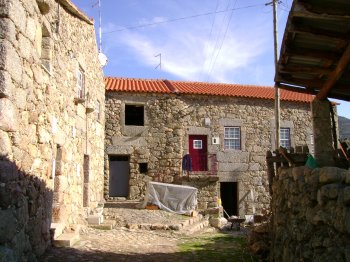
Vila Soeiro
- country
- heritage
Vila Soeiro
6300-270, Guarda
This is one of the small villages of the Natural Park of the Estrela Mountain, at an altitude of 580 metres. Most of its inhabitants are farmers these days, even though the culture of linen used to be an activity until quite recently. The houses are made of granite, which is an architectural feature of this region. Nearby, one may visit the Caldeirão dam or practise mountaineering.
Trilho da Pala da Moura
- country
Vilarinho da Castanheira
5140, Vilarinho da Castanheira
Small path Route, departing at the Church of St. Mary Magdalene of Vilarinho da Castanheira.
Pico do Carneiro
- country
Serreta
9700, Angra do Heroísmo
Peak with 383 meters above sea level located in the zona da Mata of Serreta.
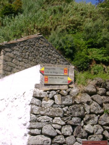
Trilho Pedestre Faial da Terra - Salto do Prego (PRC9)
- country
Rua do Burguete
9650, Outeiro
This trail begins and ends at Faial da Terra, traveling about five kilometres. The path starts along the shore, with hot water all year round, and then to the waterfall nail heel, the Place of the Sanguine and, finally, the return to Faial da Terra.
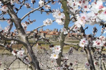
Castelo Rodrigo
- country
- heritage
Castelo Rodrigo
6440, Figueira de Castelo Rodrigo
Castelo Rodrigo is located on a steep hill, at an altitude of 820 meters, at the source of the Serra da Marofa mountain range. According to history, it was inhabited around half a millennium BC and later occupied by the Romans, still preserving two intersecting road sections from that era. It possesses a valuable collection of military and religious architecture, notably the walls of the medieval castle, the Manueline pillory, the palace of the 1st Marquis of Castelo Rodrigo, the Rocamador church, and several houses with Manueline windows. Regional crafts are characterized by lace and embroidery.
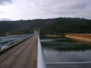
Barragem da Apartadura
- beach
- country
Rasa
7330, São Salvador da Aramenha
Dam located on the Ribeira de Reveladas (Tejo River Basin). It is used for irrigation and water supply. The Apartadura reservoir area is located within the Serra de São Mamede Natural Park. It allows for the practice of motorless water sports.
Pedra da Anicha
- country
Parque Natural da Serra da Arrábida
2900, Azeitão
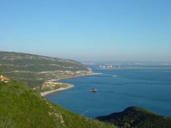
Pedra da Anixa is a zoological reserve where the characteristic plant and marine animal diversity of rocky coasts is most evident. Located in Portinho da Arrábida, it is an example of a rocky outcrop amidst vast stretches of underwater sand, giving this place a unique character.
Percurso Pedestre Rota dos Açudes (PR6)
- country
EM 526
6050, Montalvão
Beginning in the village of Salavessa, filled with typical houses, this route will be taken down the Tagus till you find a pontoon to the water edge you will get to a dam and the bowels of serra de São Miguel. In your company will be the ribeira de Fivelo, where another dam, behind which come. The extent of this ride is 10.6 km and estimated duration of the 3:30 h.
Trilho Pedestre das Furnas (PRC6)
- country
Largo das Três Bicas (ER 1-1)
9675-034, Furnas
Circular trail that starts and ends at Caldeiras das Furnas. Has an extension of about ten kilometres and a duration of three hours. The starting point is, more specifically, on all three Cocks, and then by where are made the famous cooked das Furnas and the Chapel of our Lady of victories.
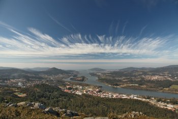
Miradouro do Cervo
- country
- leisure
Rua Nova
4920, Vila Nova de Cerveira
This is the best-known viewpoint in Vila Nova de Cerveira, located next to the Cervo sculpture, a popular iron work by sculptor José Rodrigues. Located on a hill called Alto do Crasto, it pays homage to the symbol of the village where, in the past, deer abounded. Despite being located at just 300 meters above sea level, it is amazing with its extremely beautiful and imposing views. From here you can see a large part of the Minho River, from its passage through Valença to its mouth, in Caminha. On the other side, you can see the municipality of Tominho, …