Explore the best places
Country in Portugal
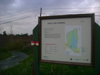
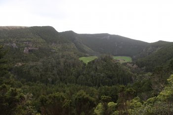
Paúl do Taipal
- country
Paúl do Taipal
3140, Montemor-o-Velho
This space, together with the Arzila and Madriz marshes, represents one of the last examples of this type of wetland in the Central Region. It is divided into the swampy area itself and a surrounding area, where there are agricultural and forested areas. It extends over 233 hectares, with a maximum altitude of 25 meters.
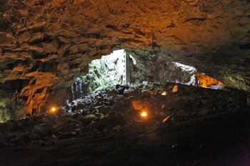
Gruta do Escoural
- country
EM370
7050, Escoural
Cave that served as the community's residence and burial site, with traces of occupation since the Middle Paleolithic. It features cave paintings and engravings from the Upper Paleolithic and late Neolithic. It has a gallery/room type configuration, consisting of 30 galleries with rooms, corridors, ramps and chambers.
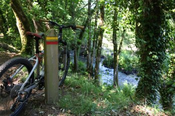
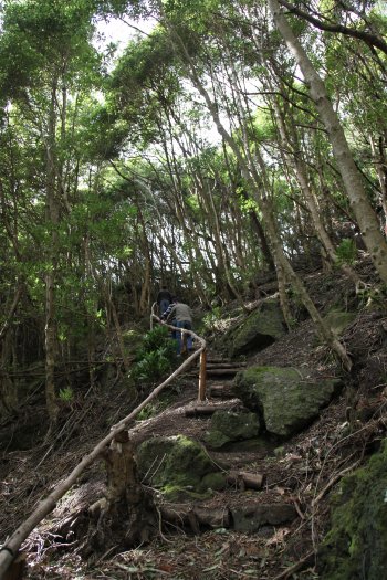
Trilho Interpretativo da Ribeira de Covas
- country
Serra de Covas
4920, Covas
This pedestrian route crosses the Covas mountain range and passes by Azenha do Pagade, over the Coura river. With a length of around 4.5 kilometers, it passes through green areas of great natural beauty. With practically no unevenness, this route is characterized by its proximity to the Minho and Coura rivers, along which the richness of the area's flora does not go unnoticed, with its native trees offering shade to walkers. Its fauna is equally rich and worthy of mention, from birds to otters. You will also pass through part of an old area that carried water from the dam …
Percurso Pedestre Pinelo-Corane-Azimute
- country
EN218-2
5230, Vimioso
Pedestrian route of approximately five kilometers.

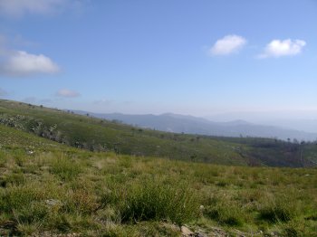
Serra da Freita
- country
Serra da Freita
3730, Arões
Serra da Freita is part of the Gralheira Massif, together with Serra da Arada and Serra do Arestal, reaching its maximum altitude at 1085 meters at Pico de São Pedro Velho, and extending through the municipalities of Arouca, São Pedro do South and Vale de Cambra. There you will find natural riches such as the Frecha da Mizarela waterfall, 75 m high, and the Pedras Parideiras, a geological phenomenon that can only be observed in Russia. These are a type of stones that are “born” from a mother rock of granite origin, and which symbolize fertility in the region’s popular …
Trilho Pedestre Serra Branca - Praia (PR1)
- country
Serra Branca
9880, Santa Cruz da Graciosa
This trail starts near the access to the Serra Branca Wind Farm, ending then in Praia. It crosses Graciosa Island from the west coast to the east coast, passing Pico das Caldeirinhas, the highest of the Serra Branca volcanic cones, measuring around 360 meters.
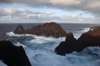
Ilhéu da Baleia
- country
Ponta da Barca
9880-303, Santa Cruz da Graciosa
This curious basalt formation of volcanic origin resembles, in profile, the shape of a whale, which gives it its name. It is located in the small bay of Ponta da Barca.
Trilho Pedestre Volta à Caldeira - Furna do Enxofre (PRC2)
- country
ER2-2
9880-205, Santa Cruz da Graciosa
This trail starts and ends next to Canada Longa, passing through Furna do Enxofre and Furna da Maria Encantada, where there is a viewpoint with superb views. After surrounding the Caldeira, it ends at Cana Longa.
Caldeira
- country
Caldeira
9880-205, Santa Cruz da Graciosa
Classified as a Regional Natural Monument, this large crater is covered with vegetation, creating a broad green blanket of great natural beauty. Inside, we find Furna do Enxofre, one of the island's landmarks.
Furna do Enxofre
- country
Caldeira
9880-205, Santa Cruz da Graciosa
This geological phenomenon of great spectacularity and beauty is located inside Caldeira da Graciosa. This lava cave features a circular depression 1600 meters in diameter and 350 meters deep, in the place where the top of a volcano that gave rise to the island was previously located. At the bottom, there is a lake of cold, sulfurous water. The exploration of this cave began in the 19th century by several researchers, including Prince Albert of Monaco.