Explore the best places
Country in Portugal
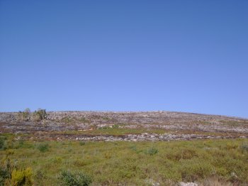
Pedra da Anicha
- country
Parque Natural da Serra da Arrábida
2900, Azeitão
Pedra da Anixa is a zoological reserve where the characteristic plant and marine animal diversity of rocky coasts is most evident. Located in Portinho da Arrábida, it is an example of a rocky outcrop amidst vast stretches of underwater sand, giving this place a unique character.
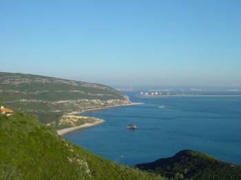
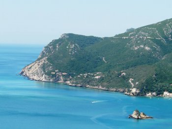
Parque Natural da Arrábida
- country
Estrada da Rasca
2900-579, Setúbal
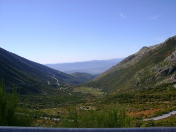
The Arrábida Natural Park encompasses a series of landforms that form the Arrábida mountain range. This park was created with the aim of preserving the natural, socio-cultural, economic, and historical values of the region. The natural and scenic importance of this area is enormous, due to its rare natural characteristics and scarce human development. At first glance, it seems like a wall over the Atlantic – the Alto dos Píncaros, at the top of the Serra do Risco, at 400 meters altitude, drops abruptly into the Atlantic – but the Arrábida Natural Park hides a multiplicity of morphologies that make …
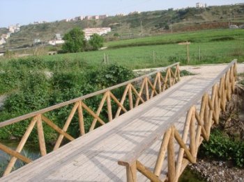
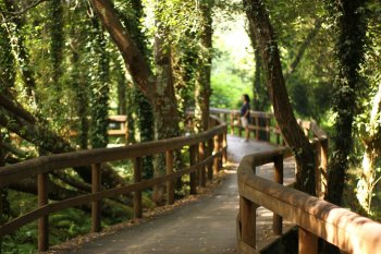
Ecopista Escola Agrícola da Paiã
- country
Estrada da Paiã
1675, Pontinha
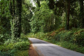
Located at the Dom Dinis Agricultural Professional School in Paiã, the Ecopista (Eco-trail) is designed for walking and cycling, allowing users to follow paths that, in an almost magical effect, make visitors feel an integral part of the landscape. It's an opportune moment to observe sheep, cattle, and horses, contemplate the flight of birds, and discover herbs and shrubs that perfume the paths.
Serra da Estrela
- country
EN339
6215, Unhais da Serra
Some say it's more charming in winter because of the added beauty the snow provides, but there are plenty of reasons to visit during the warmer months as well. Starting with the protected area of the Serra da Estrela Natural Park, with its rich fauna and flora, and ending at Torre, the highest point in mainland Portugal. There's much to explore on foot or by car. Another unmissable highlight is Serra da Estrela cheese.
Serra de Sintra
- country
Serra de Sintra
2710, Sintra
Located west of Lisbon, it belongs to the sedimentary fringe of Estremadura. It is 10 kilometers long, 5 kilometers wide and 30 kilometers in perimeter, reaching its maximum altitude (540 meters) at Cruz Alta. Integrated into the Sintra/Cascais Natural Park, it is divided into two landscapes: one is the extensive agricultural area north of Colares that encompasses the São João das Lampas plateau, the other is the coastal strip between the mouth of the Falcão River and the Citadel of Cascais, ending at Cabo da Roca. Presenting magnificent natural beauty, due to the variety of vegetation, paths and lakes, it …
Fajã dos Padres
- country
Rua Padres António Dinis Henriques, 1
9300-261, Quinta Grande
A paradisiacal place, located in a cove at the bottom of the famous Cabo Girão cliff. Until 1998, access was only possible by boat, but now there is a modern glass elevator. There is a small tourist resort here that includes a restaurant, good conditions for sunbathing and fishing, and some tourist accommodation.

Gruta do Carvão
- country
Rua do Paim
9500-230, Ponta Delgada
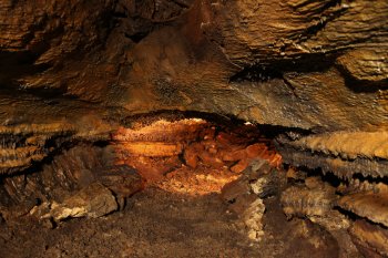
This volcanic geological formation is approximately 1650 meters long and has an average height of two to three meters, with some places exceeding five meters. Its width varies considerably, reaching up to ten meters. Be sure to notice the beautiful stalactites of lava origin on the ceiling, with their conical shapes and smooth surfaces.
Ponta da Ferraria
- country
Ponta da Ferraria
9555, Ginetes
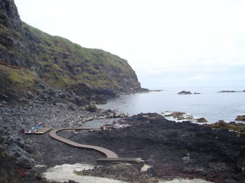
The area has been classified as a regional natural monument and protected landscape. It offers a privileged view of the sea, and this crater was formed as a result of small steam explosions caused by the contact of lava with seawater. There is also a spa and some natural pools at this site.
Passadiços de Fiães
- country
Rua Rio Uima
4505-335, Santa Maria da Feira
An integral part of the Ribeiras Park in Fiães, these walks are characterized by the beauty of the surrounding landscape. The park is accessible to people with reduced mobility and visual impairments; along the trails you will find information panels about the flora and fauna found there.
Serra de Sicó
- country
Serra de Sicó
3100, Vila Cã
This mountain range, at 553 meters altitude, belongs to the sedimentary edge of Estremadura, located east of Pombal. Situated east of Pombal, it divides the hydrographic basins of the Soure and Nabão rivers and measures 7.5 km in length. Its limestone formations contain an original set of caves, grottos, sinkholes, and escarpments. The vegetation at its base and on its slopes reveals cultivated fields of wheat and vegetables, pine forests, patches of oak groves, and a great variety of plants. It offers conditions suitable for climbing, paragliding, and various hiking trails.