Explore the best places
Results for Serra+da+Estrela in Portugal
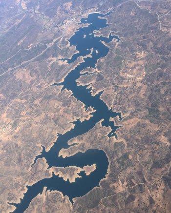
Barragem de Odeleite
- beach
- country
Odeleite
8950, Odeleite
Located in Odeleite, Castro Marim, this dam was built on the Ribeira de Odeleite, which originates in the Serra do Caldeirão mountain range. Interestingly, in aerial photographs, it resembles a dragon.
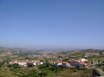
Miradouro dos Casais
- country
- leisure
CM1211
2590, Sobral de Monte Agraço
Located in a fairly high spot, in the heart of the Serra de Montagraço mountain range, from here it is possible to appreciate a beautiful landscape that stretches across a vast valley to the Atlantic.
Lagoa Comprida
- beach
- country
EN339
6270-277, Seia
A lagoon with a length of 2500 metres and a width of 130 metres, located in the Estrela Mountain Natural Park, near the Escura, Seca and Redonda lagoons. The mountain scenery stands out for being covered with grass, due to the abundant rainfall. Huge granite blocks are also visible.
Caos Granítico das Muas/ Arnal
- country
EM1214
5000, Arnal
Localizado na serra do Alvão, o aos granítico de Arnal apresenta uma paisagem única de rocha nua, que contrasta com o verde do vale. Pode conhecer esta paisagem fazendo o percurso Agarez - Arnal.
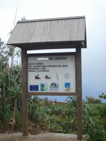
Percurso Pedestre da Vereda da Ladeira
- country
Caminho dos Pombais
9270, Pombais
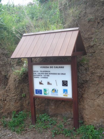
A 4 kilometres long pedestrian walk that starts at Borda and ends at the Calhau das Achadas da Cruz. The walk lasts about two hours and thirty minutes.
Percurso Pedestre Rota dos Recantos e Encantos (PR5)
- country
EM544
6150, Proença-a-Nova
This trail begins and ends at the river beach of Alvito da Beira. It is 11.4 km long, takes about 3 hours, and has a medium level of difficulty. The main points of interest on this trail are the village of Alvito da Beira itself, Lameira da Mó, and Cova do Alvito.
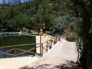
Percurso Pedestre da Vereda da Achada do Calhau
- country
Caminho do Teleférico
9270, Achadas da Cruz
A pedestrian walk that starts at the aerial cableway of Porto Moniz and proceeds for 4.5 kilometres until the Calhau da Achada da Cruz. The walk last about two hours.
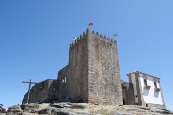
Belmonte
- country
- heritage
Vila Histórica de Belmonte
6250, Belmonte
The small town of Belmonte is located on a hill, on the east slope of the Estrela Mountain, by the Cova da Beira and the Zêzere River. The romanesque church of Saint Tiago and the castle stand out in its urban medieval set, as well as the Tower "Centum Cellas", of the 1st to 4th centuries AD, built by the romans, and several vestiges of menhirs and castros (a celtic village). The local Jewish community, that still keeps to the old habits, is an interesting feature. The new church has the image that Pedro Álvares Cabral may have taken on …
Trilho Pedestre da Lomba da Fazenda (PRC31)
- country
Boca da Ribeira
9630, Lomba da Fazenda
Circular pedestrian route that starts and ends in front of the Church of Nossa Senhora da Conceição, in Lomba da Fazenda. It is approximately seven kilometers long and lasts two hours. Along the trail you will pass the Nordeste campsite, the Boca da Ribeira bathing area, the Pelado Endémicas Park and the Morgada Park.
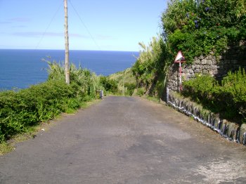
Caminho Real da Encumeada
- country
Estrada da Corrida
9325, Boca da Corrida
Footway with a bout 12 km, stretching from the Boca da Corrida until the Curral das Freiras. It was a former royal way and a trading track and there’s even a record of a grocery along the way.