Explore the best places
Results for Serra+da+Estrela in Portugal
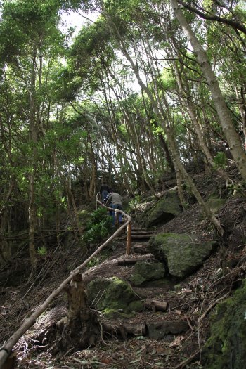
Trilho Pedestre Volta à Caldeira - Furna do Enxofre (PRC2)
- country
ER2-2
9880-205, Santa Cruz da Graciosa
This trail starts and ends next to Canada Longa, passing through Furna do Enxofre and Furna da Maria Encantada, where there is a viewpoint with superb views. After surrounding the Caldeira, it ends at Cana Longa.
Foz do Rio Sabor
- beach
- country
Rio Sabor
5160-035, Moncorvo
The Sabor River originates in the Serra de Gamoneda (Montes de León), in the Spanish province of Zamora, at around 1600 meters above sea level, then runs for more than a hundred kilometers in Trás-os-Montes and ends up flowing into the Douro River, close to Moncorvo Tower. It is considered one of the purest rivers with the greatest ecological value in Portugal.

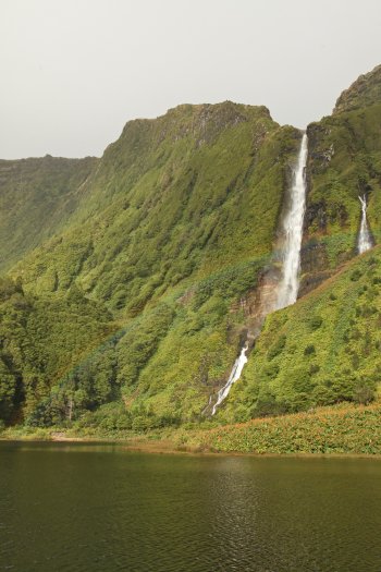
Queda de Água do Poço da Alagoinha / Lagoa das Patas
- beach
- country
Poço da Alagoinha
9960-030, Lajes das Flores
A place of extreme natural beauty, an almost virgin place where silence prevails. It's worth a visit. The lagoon formed by the waterfalls is known as Poço da Alagoinha or Lagoa das Patas because, during the migration of wild ducks, they remain in this lagoon for days.
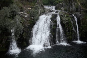
Parque Cénico da Cascata do Poço da Broca
- country
Barriosa
6285-059, Vide
A Cascata do Poço da Broca é uma queda de água de grande beleza, localizada na ribeira de Alvôco. Em redor, forma-se uma aprazível praia fluvial.
Trilho Pedestre Pico do Ferro - Caldeiras da Lagoa das Furnas (PR22)
- country
Furnas
9675, Furnas
This route starts at the miradouro do Pico from iron and ends in the boilers of Lagoa das Furnas, with a duration of approximately an hour and a half. After passing through the lookout, begins to descend the cliffs, passing by a small watercourse.

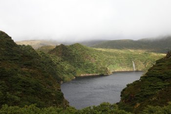
Trilho Pedestre da Poça do Bacalhau (PR3)
- country
Poça do Bacalhau
9960-030, Lajes das Flores
This trail starts at Miradouro das Lagoas, passes through Caldeira Seca and Caldeira Branca, providing beautiful views over Fajã Grande. It crosses two reserve areas: Site of Community Interest and Forest Reserve.
Trilho da Penoita
- country
EN 622
3670, Ventosa
This trails is 13 km long and there is the possibility of a smaller 4 km long path. It starts at the Parque de Merendas da Penoita (Penoita's Picnic Area) and is in full touch with nature, as well as a few archaeological vestiges.
Paul da Praia da Vitória
- country
Rua Comendador Francisco José B. Barcelos
9760-587, Praia Da Vitória
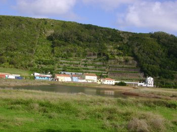
Wetland located in the quota too low and near the urban center of the city. It is a coastal lagoon associated with the existence of a graben and dune system. The proximity of Praia da Vitória makes this paul very rare in the region of Macaronesia.
Cabeço do Caveiro
- country
Lajes do Pico
9930-170, Lajes do Pico
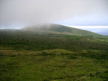
Elevation located at approximately 972 meters above sea level, close to large pyroclastic formations. Nearby, you can find Lagoa do Ilhéu, the Chã do Pelado elevation and Lagoa da Rosada.
Gruta das Anelares / Furna das Anelares
- country
Ribeira da Lombega
9900, Horta
Located in Ribeira da Lombega, this is one of the three existing lava tubes on the island, featuring 36 meters long and 4 meters high. Its name comes from the fact that there are ring-shaped stalactites in caves.