Explore the best places
Country in Portugal
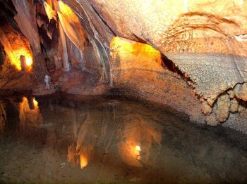
Grutas de Alvados
- country
Rua das Grutas
2480-034, Alvados
Discovered in 1964, they are located on the Minde hill, in an area where these formations abound. They are configured like a gallery/room/well. A special note to the stalactites, stalagmites and illumnitaed lakes in the interconnected rooms.
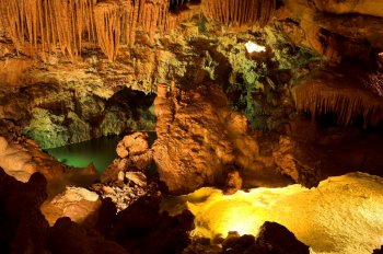
Grutas de Mira d'Aire
- country
Avenida Doutor Luciano Justo Ramos, 470
2485-050, Mira de Aire
Discovered in 1947, these are the largest caves in Portugal. They are configured like a gallery/room/well and their formation is due to erosion and to tectonic changes. There are subterranean lakes and rooms with lovely calcareous formations. There are two elevators and a depth of 110 metres. Here one finds the Grande Lagoa (Large Lagoon), formed by the Rio Negro (Black River), a subterranean water course that, in the winter, forms the Mira de Aire Lagoon.
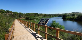
Passadiços do Gameiro
- country
Parque Ecológico do Gameiro
7490, Mora
These walkways are part of the Gameiro Ecological Park and are 1.5 km long, starting next to Gameiro River Beach. A route marked by unique beauty, along the way you will find all the information about the species of flora that mark its landscape, from trees to flowers and shrubs.
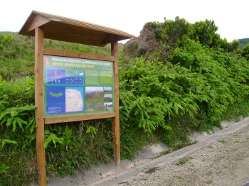
Trilho Pedestre Lomba da Fazenda - Pico da Vara (PR8)
- country
EM 1035
9630, Lomba da Fazenda
This pedestrian path begins in Lomba da Cruz, parish of Lomba da Fazenda and ends at the highest point of the island, the Pico da Vara. Has an extension of about eight kilometres (five miles) and lasts around five hours.
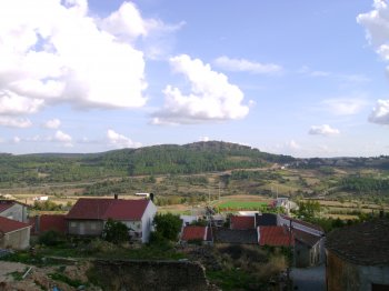
Serra de Mogadouro
- country
Mogadouro
5200, Mogadouro
Belonging to the Ancient Massif of Trás-os-Montes, this mountain is located in the extreme northwest of the national territory, between the Douro River and the Sabor River, rising to around 993 meters. The forest landscape has a predominance of pine and chestnut trees, interspersed with some cultivated spaces. The excellent viewpoints stand out: Pico de São Cristóvão and Alto da Castanheira.
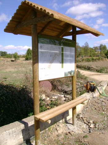
Trilho do Azeite
- country
Rua do Abecheiro
5200-090, Mogadouro
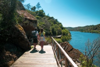
Short walking route, suitable for walking or driving, integrated into the Douro International Park. With a length of around nine kilometers, it takes four hours on foot and one hour by car. It begins and ends at the Rural Interpretation Center, in the village of Bruçó, following paths through olive groves, among the cliffs of the Douro River. At the end of the trail, you can visit the traditional olive oil press, in the same village.
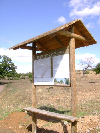
Trilho da Castanha
- country
Bruçó
5200-090, Mogadouro
Short route, intended to be done on foot or by 4X4, with a length of around eleven kilometers. It takes five hours on foot or an hour and a half in a 4X4. It starts and ends at the Rural Interpretation Center in the village of Bruçó (where you can purchase products made with chestnuts), traveling through land occupied by chestnut trees, with emphasis on a century-old chestnut tree.
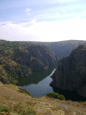
Parque Natural do Douro Internacional
- country
Rua Dr. Francisco António Vicente, 4
5200-241, Mogadouro
Integrating the municipalities of Figueira de Castelo Rodrigo, Freixo de Espada-à-Cinta, Miranda do Douro and Mogadouro, the Douro Internacional Natural Park covers the 122 kilometers of border section of the Douro River and extends south, to the Douro Valley. From a very deep valley and two plateau areas (essentially granite), one to the North with altitudes of around 700-800 meters and the other to the South with altitudes of around 600-700 meters. The gorges carved by the Douro and Águeda rivers are extremely deep (up to 200 meters) and of great beauty. The Park reaches its maximum altitude (895 meters) …
Passadiços do Alamal
- country
Praia Fluvial do Alamal
6040-024, Gavião
The Alamal Walkways, starting next to Ponte de Belver or Praia Fluvial do Alamal, are located on the banks of the Tagus River, and are located in a valley of rare beauty. They are an integral part of PR1-GAV Arribas do Tejo, a 16 km circular pedestrian route. With low difficulty, these walkways can be walked at any time of year.
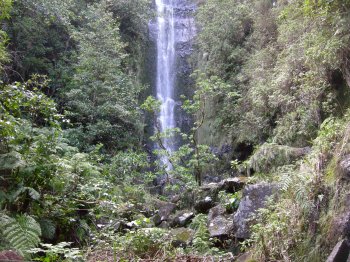
Floresta Laurissilva de Chão da Ribeira
- country
Chão da Ribeira
9270, Seixal
This area of the parish of Seixal covers a portion of the vast area of laurisilva, Madeira's original forest that currently occupies 22% of the island's surface. It is characterized by a humid subtropical climate and large trees, mainly laurel, whitewood and cedar, constituting an ecosystem of high importance. It is classified as a World Natural Heritage Site by UNESCO.