Explore the best places
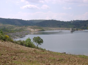
Barragem do Azibo
- beach
- country
Barragem do Azibo
5340, Vale da Porca
Earthen dam on the Azibo River, Douro Basin, framed by a mountainous landscape. Recreational activities are permitted, with restrictions.
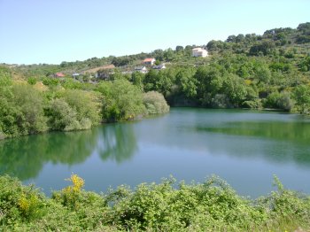
Barragem da Carvalheira
- beach
- country
Barragem da Carvalheira
5340, Amendoeira
Dam located on the Ribeira de Amendoeira (Douro River Basin), framed by patches of trees. Fishing is restricted.
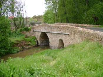
Ponte de Cernadela
- heritage
Cernadela
5340, Cernadela
Medieval bridge, with two unequal round arches.
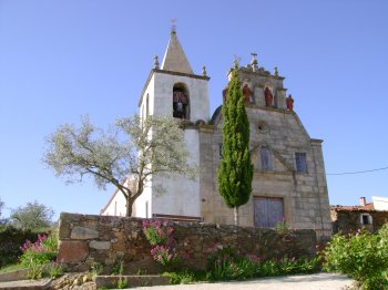
Igreja Paroquial de Vilarinho de Agrochão / Igreja de Santo Antão
- heritage
Travessa do Solar II, 9
5340-500, Vilarinho de Agrochão
An 18th-century temple whose highlight is the statuary that occupies the niches of the facade on the exterior. Also, noteworthy is the carved decoration.
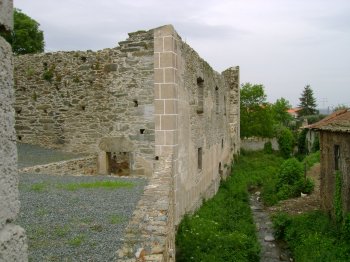
Real Filatório de Chacim
- heritage
Chacim
5340, Chacim
Building that housed a water-powered silk spinning factory.
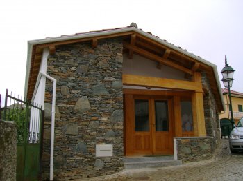
Casa de Exposição e Artesanato de Carrapatas
- leisure
Carrapatas
5340, Carrapatas
Space where farmers can display and sell local produce and craft items.
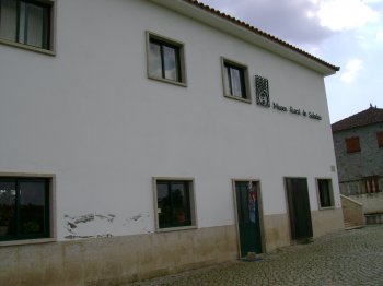
Museu Rural de Salselas
- heritage
Salselas
5340, Salselas
An ethnographic museum, transformed into a core center of ruralism. The permanent exhibition showcases the human aspects of any Trás-os-Montes village: peasant objects, folk art, and objects that demonstrate the transition from rurality to industrialization.
Museu Municipal de Arqueologia Coronel Albino Pereira Lopo
- heritage
Rua Dona Maria Mascarenhas
5340-308, Macedo de Cavaleiros
In the former Trinta Primary School, more than 5,000 years of history are now on display, with various archaeological pieces, gathered in two chronological areas.
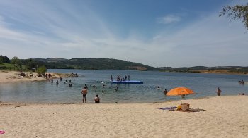
Praia Fluvial da Ribeira - Albufeira do Azibo
- beach
Praia Fluvial da Ribeira
5340, Podence
A beach adapted for people with reduced mobility, it offers a range of facilities such as playgrounds, a children's playground, bars, and pedal boat, bicycle, and pedal-powered vehicle rentals.
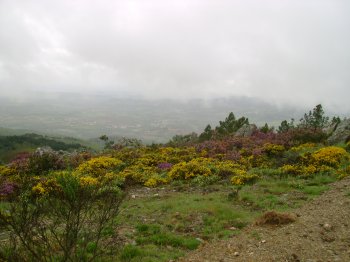
Serra de Bornes
- country
Serra de Bornes
5340, Olmos
It belongs to the Old Massif and is located in the east-central region of Trás-os-Montes, between the Sabor and Tua rivers. It is over 12 km long and 5 km wide, reaching its highest point at 1,200 meters, above the Vilariça valley. The region is characterized by mountain ranges, small high-altitude plateaus, deep, hollow valleys, some watercourses, and open valleys. The flora ranges from chestnut trees to cork oaks, olive trees, almond trees, cherry trees, orange trees, and vineyards. It is noteworthy that, until a few years ago, rye was cultivated at an altitude of about 1,000 meters.