Explore the best places
Results for Serra+da+Estrela in Portugal
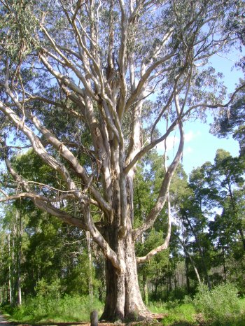
Árvore Notável (Eucalipto)
- country
Árvore Notável (Eucalipto)
2430, Marinha Grande
An eucaliptus tree on the Estrada das Matas (Woods Road), that stands out for being 48 metres high and 46 metres wide.
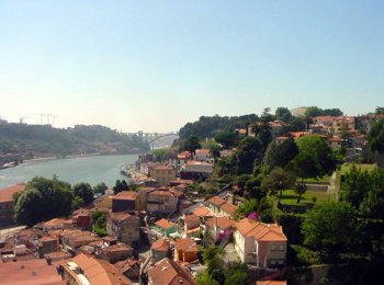
Panorâmica do Rio Douro vista do Passeio das Virtudes
- country
Passeio das Virtudes
4050, Porto
The Passeio das Virtudes is leaning over the Calçada das Virtudes, which ends at the Virtudes Fountain. Being a balcony over Miragaia, it offers a beautiful view of the landscape spreading out from the river till its mouth. Here you will find the Cooperativa Árvore head-office, which is the stage for several cultural activities.
Trilho Pedestre da Praia da Viola (PR27)
- country
Largo da Igreja (ER 1-1)
9625, Maia
This route begins in Lomba da Maia, next to the Church and follows the path of an grassland area which gives access to a shortcut up post that descends towards Praia da Viola. The long beach you will find several streams with water running through the cliffs from the beach and also the typical watermills, surrounded by Yams
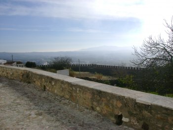
Marvão
- country
- heritage
Marvão
7330, Marvão
This small group of houses is located by the Marvão mountain. Located inside 17th century walls, it stands out for its unity and homogeneity. Located near Spain, this border fortress that exists since the 12th century had its first charter in the 13th century. A special note to the castle, a National Monument, the Convent of Our Lady of Estrela (Star), the pillory and several churches. A nice area for mountaineering.
Miradouro do Castelo de Estremoz
- country
- leisure
Largo Dom Dinis
7100, Estremoz
From the top of the Castle of Estremoz, one may view several villages along the Alentejo plains. In the clearest days one may even view the Estrela Mountain to the north. Closer by, marvão, Portalegre, Alter do Chão, Cabeço de Vide, Fronteira and Monforte are ar whithe-ish dots on the northern landscapes. From the other side, one has views of the houses in Évora.
Área Recreativa de Arga de São João
- country
- leisure
Arga de São João
4910, Caminha
Wide green area with tables and benches, located in the Serra De Arga. Sierra which at its highest reaches over 800 meters above sea level and located overlooking the valleys of the rivers Coura, anchor and Lima. This recreation area has some footpaths not flagged.

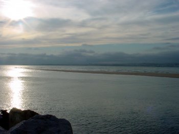
Foz do Rio Tejo
- beach
- country
Foz do Rio Tejo
2825, Lisboa
The Tagus River flows into the beautiful Tagus estuary, after traveling 875 km from the Serra de Albarracín. The estuary is a place well known for the passage of migratory birds. One of the few terrestrial accesses can be made near Porto Alto (in Reta do Cabo).
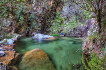
Cascata de Pincães
- beach
- country
Cabril
5470-011, Cabril
Esta é uma das cascatas mais bonitas do Parque Nacional da Peneda-Gerês. Para lá chegar, deve seguir o caminho que vem da aldeia por um trilho com cerca de dois quilómetros.
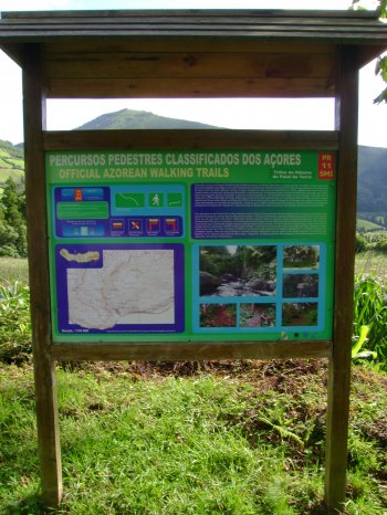
Trilho da Ribeira do Faial da Terra (PR11)
- country
ER 1-1
9650, Água Retorta
This pedestrian path starts at the Forest Park of Água Retorta and ends at Faial da Terra. Has about 6.5 kilometers long and lasts around an hour and a half. On the road will pass through pastures, an abandoned mill, a century-old bridge, several forests, small streams, a waterfall nail heel, ending after the Faial da Terra.
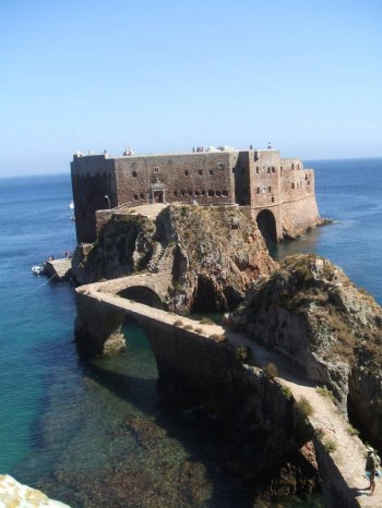
Ilha da Berlenga
- country
Ilha da Berlenga
2520-644, Peniche
O Arquipélago das Berlengas é um pequeno arquipélago a Noroeste de Peniche e do Cabo Carvoeiro. A Ilha de maiores dimensões é a Ilha Berlenga Grande (ou simplesmente Ilha da Berlenga), mas o arquipélago é formado por uma série de outras ilhotas em seu redor, as Estelas e os Farilhões-Forcadas. A única Ilha habitável é a Berlenga Grande, com um pequeno bairro de pescadores, um porto, o Farol Duque de Bragança, o Forte de São João Baptista, uma zona de campismo e um restaurante. É Reserva Mundial da Biosfera da UNESCO desde 2011.