Explore the best places
Country in Portugal
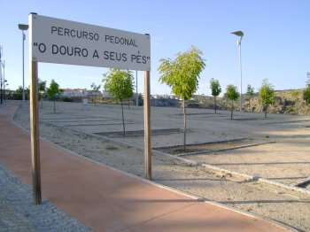
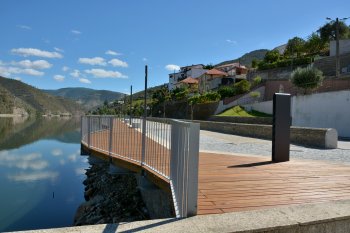
Percurso Pedonal O Douro a Seus Pés
- country
EN218
5210-003, Miranda do Douro
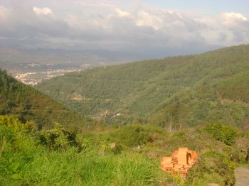
This walking trail stretches along the Douro River slope, from the old Customs building to the former Pousada de Santa Catarina. Enjoy the wonderful views of the river while soaking up the tranquility of the place.
Percurso Pedestre da Herdade da Coitadinha
- country
EN258
7230, Barrancos
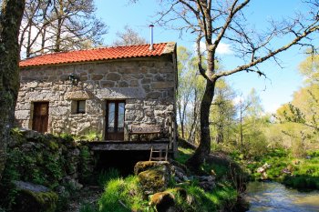
Trail near Herdade da Coitadinha, located in the Noudar Nature Park, part of the Natura 2000 network. The estate is a thousand-hectare property, about seven kilometers northeast of Barrancos. These lands are not located on the banks of the Alqueva River, but rather in what is considered the reservoir's area of influence.
Percurso no Parque Peneda-Gerês
- country
Germil
4980, Germil
Peneda-Gerês National Park is one of Portugal's greatest natural attractions, due to its rare and impressive scenic beauty and ecological value and variety of fauna and flora.
Percurso Pedestre dos Moinhos de Parada
- country
Parada
4980, Lindoso
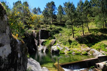
A hiking trail known as a short route, in the parish of Lindoso, near Parada. The walk includes a passage through dense vegetation and old abandoned mills, as well as along the beautiful slopes of the Lima River. A highlight is the natural pool known as Poço da Gola, where you can enjoy a unique and paradisiacal space.
Parque Nacional da Peneda-Gerês
- country
Lugar do Castelo
4980-451, Lindoso
It encompasses a total of 22 parishes, distributed across the municipalities of Arcos de Valdevez, Melgaço, Montalegre, Ponte da Barca, and Terras de Bouro. A National Park and Protected Area since 1971, it stretches from the Castro Laboreiro plateau to Mourela, home to a vast array of flora and fauna, making it a favorite setting for outdoor activities. Typically accessible by car, it's known for its rugged terrain and steep slopes, and is primarily a granite region. You can take various routes, on foot or by car, and enjoy the landscape that offers a true journey through nature, the past, …
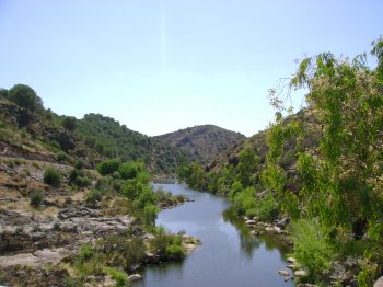
Passeadouro da Folgosa
- country
EN222
5110-204, Folgosa
Panoramic pedestrian path that allows you to enjoy an open-air stroll along the Douro River.
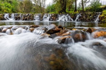
Açude das Casas da Ribeira
- country
Casas da Ribeira
6120, Mação
The Casas da Ribeira reservoir is a paradisiacal place, located in Ribeira de Eiras.
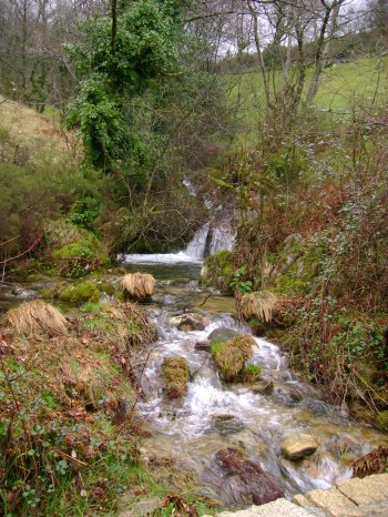
Pego da Rainha
- country
Zimbreira
6120, Mação
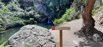
Pego da Rainha, located near the village of Zebreira, is a waterfall that forms a lagoon. The name comes from the story of a queen who used to bathe in the natural pool beneath the waterfall.
Baloiço Panorâmico de Mação
- country
Serra do Bando dos Santos
6120, Mação
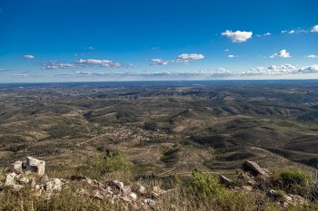
This wooden structure, located at one of the highest points in the Santarém district, offers a panoramic view of the entire area south of Bando dos Santos, where the villages of Santos and Pereiro are visible, and further back, the town of Mação.
Serra da Lousã
- country
Serra da Lousã
3200, Lousã
This mountain range is located between the Açor and Sicó mountains, southwest of Coimbra, on the border with the district of Leiria. It measures 30 kilometers long and 30 kilometers wide, reaching its highest point of about 1,000 meters at Alto do Trevim. It is a mountain range deeply furrowed by a branching network of valleys and steep slopes on its northwestern edge. It boasts a rich fauna and flora, boasting a wide variety of botanicals, and even some watercourses, the famous Lousã river pool. Along the mountain range, trails lead us to villages frozen in time, populated by schist …