Explore the best places
Results for Serra+da+Estrela in Portugal
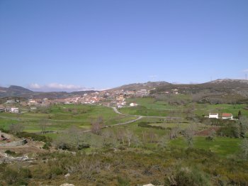
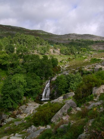
Cascata de Galegos da Serra
- beach
- country
Galegos da Serra
5000, Galegos da Serra
In the Natural Park of Alvão, about 5 kilometres away from the centre of Vila Real, the 20 metres tall Galegos da Serra waterfall shows itself majestic. Due to the intense fracturation one can clearly view deep alterations in the granite. The mill of Ribeira de Arnal (road Agarez/Galegos da Serra) completes this unique watercolour of Trás-os-Montes.
Percurso Pedestre de Alqueidão da Serra
- country
Alqueidão da Serra
2480, Porto de Mós
A 9 km long circular pedestrian trail with signals. Alqueidão da Serra is a calcareous area and the trail starts out on a roman road.
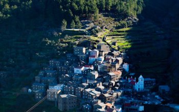
Serra de São Macário
- country
Serra de São Macário
3660, São Pedro do Sul
The São Macário Hill is located to the north of São Pedro do Sul and reaches its peak at Castro Magaio, at an altitude of 1053 metres. From the hilltop one has wonderful views, namely the Montemuro hill and the Estrela Mountain, as well as the small towns and villages lost in the hills.
Serra de Santa Helena
- country
Serra de Santa Helena
3610, Tarouca
Located in one of the foothills of the Serra de Montemuro, a Sanctuary stands out at the top of the Serra de Santa Helena. From this point you can see a beautiful landscape with the town of Tarouca at the foot.
Serra do Caldeirão
- country
Serra do Caldeirão
8150, São Brás de Alportel
The Serra do Caldeirão is predominantly an agro-forest area. It owns all the characteristics of the most sadden rural areas, from which the aging of the population, the strong emigration, and the human and ecological desertification are proof, an activity based on traditional subsistence agriculture.
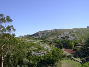
Serra de Montejunto
- country
Serra de Montejunto
2550, Lamas
The Serra de Montejunto is fifteen kilometers long and reaches 666 meters at its highest point, from where you can enjoy a vast panorama. The dominant vegetation is holm oak and kermes oak. There is a great abundance of water, coming from the springs that surround it.
Serra do Muradal
- country
São Torcato
6160, Oleiros
Located northeast of Oleiros, it reaches its maximum altitude at 800 meters. The mountain is surrounded by four hills, each topped by a chapel. The viewpoint that exists in Serra do Muradal provides a privileged view over a vast expanse of pine trees, shale towns and villages.
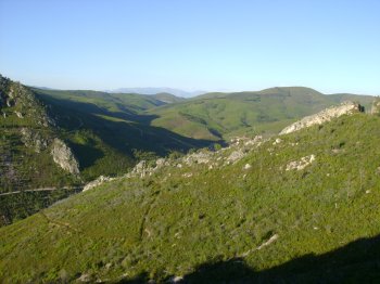
Serra de Leomil
- country
Serra de Leomil
3620, Moimenta da Beira
Located to the southwest of Moimenta da Beira, the hill grows between the Paiva and Távora rivers and belongs to the Galician-Douro massif. It is 10 km long and reaches its peak at an altitude of 1011 metres. From the peak there are wonderful views of the Tedo, Paiva and Távora valleys, as well as the tops of the Marão, Estrela, Caramulo and Montemuro mountains. Once named Nave Hill, archaeological elements were found here, such as vestiges of roman roads, stones that indicate the presence of fortresses, mamoas and menhirs. The flora includes the pine trees, the Portuguese broom, the …
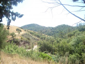
Serra do Açor
- country
Serra do Açor
6285, Piódão
It belongs to the Old Massif, located in the central country, and it is separated from the Estrela Mountain by the Alva river valley. It is 33 km long and 12 km wide. A part of the Protected Landscape of the Açor Hill, it is mostly composed of schist and has strong but roundish contours. At times there are valleys, water courses and interesting places, such as the waterfalls at Fraga da Pena. In this protected area, also a special note to the Margaraça Woods, of huge natural value, a part of the european network of biogenetic reservations. The vegetation …
Serra do Barroso
- country
Serra do Barroso
5460, Serra do Barroso
This hill belongs to the Old Massif and is placed between the Larouco, Cabreira and Marão mountains. To the north, the hill separates the basins of the Cávado and Tâmega rivers. It is also known by the name of Serra as Alturas (Hill of the Heights), it is 8 km long and it is located on the northwest of the Trás-os-Montes region. The Carvalhelhos springs are located there.