Explore the best places
Results for Serra+da+Estrela in Portugal
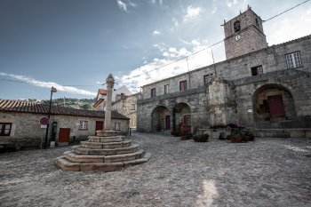
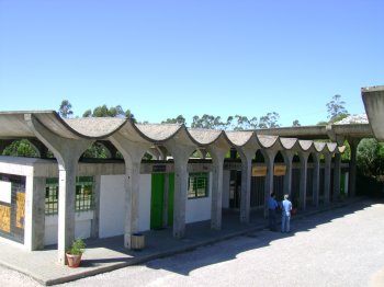
Castelo Novo
- country
- heritage
Castelo Novo
6230-160, Fundão
Village located at an altitude of about 700 meters, at the foot of the Serra da Gardunha, where traces of occupation in the Roman period are visible. In this locality stand out the medieval castle, in ruins, with the keep, the Manueline pillory, the D. João V fountain, the Igreja Matriz, of Pombaline design, several manor houses and Lagariça. The miniatures in wood and iron, lace and regional embroidery constitute the local handicraft.
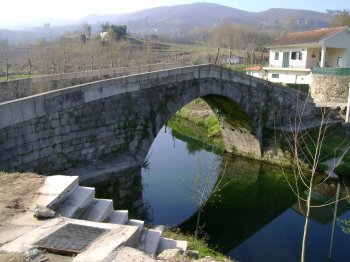
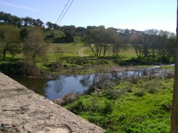
Foz do Rio Cabril
- beach
- country
EN304
4880, Mondim de Basto
The Cabril River originates in Serra do Alvão, passing through Adoufe and flowing into the Tâmega River. The best place for swimming is located next to the Medieval Bridge.
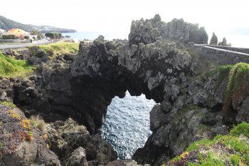
Arco Natural de Velas
- country
Avenida dos Baleeiros
9800-548, Velas
This natural arch in basaltic lava, located in Fajã da Ribeira da Areia, is so imposing that it arouses much curiosity.
Grutas de Santo António
- country
Rua das Grutas
2480-034, Alvados
Discovered in 1955, they are part of a group of caves in the Serra de Minde mountain range. Their configuration is gallery/chamber type, with the unique feature of ventilation through a natural chimney. Replete with stalactites and stalagmites, the largest chamber is approximately 6000 m2 and can be visited.
Trilho Pedestre Lomba da Fazenda - Pico da Vara (PR8)
- country
EM 1035
9630, Lomba da Fazenda
This pedestrian path begins in Lomba da Cruz, parish of Lomba da Fazenda and ends at the highest point of the island, the Pico da Vara. Has an extension of about eight kilometres (five miles) and lasts around five hours.
Ribeira de Seda
- beach
- country
Seda
7440, Seda
Ribeira de Seda originates in Serra de São Mamede and crosses the municipalities of Portalegre and Crato, entering Alter do Chão and then flowing into the Maranhão dam, in Avis.
Mosteiro
- country
- heritage
Mosteiro
3570, Mosteiro
A village at the pena Verde parish, mostly famed for its gastronomy and its culture. It has around 200 inhabitants who are mostly farmers and cattle raisers. There is a yearly Estrela Mountain cheese celebration. It also has colourful celebrations every two weeks.
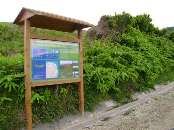
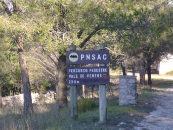
Percurso Pedestre Vale de Ventos
- country
Rua Doutor Augusto César Silva Ferreira
2040, Alcobertas
A 2.5-kilometer trail integrated into the Serras de Aire e Candeeiros Natural Park. The starting and ending points are the Vale de Ventos Welcome Center. Its main attractions, traditional architecture, flora and fauna, and panoramic views, make this tour a pleasant surprise.
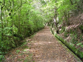
Levada dos Cedros
- beach
- country
ER209
9270, Ribeira da Janela
Levada dos Cedros is one of the many typical irrigation canals in Madeira, originating in the outcrops of Lombo do Cedro, at around 1000 meters above sea level, on the eastern slope of Ribeira da Janela. Along the canal, it is possible to observe indigenous vegetation such as leaf litter, grapevines and uveiras-da-serra. It is one of the oldest levadas on the island, built in the 17th century and, like its counterparts, it is used to collect water and convey it to areas for agricultural and domestic use. It is included in the Laurissilva World Heritage classification and is part …
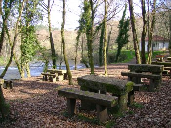
Zona de Lazer de Covas
- country
- leisure
EN 301
4920, Vila Nova de Cerveira
Wide green area located next to EN 301, between the Serra de Arga and the Sierra de graves. The room has tables and benches and access to the river Coura.