Explore the best places
Country in Portugal
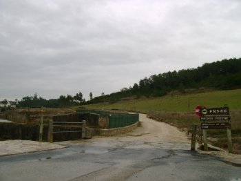
Percurso Pedestre - Marinhas do Sal
- country
Estrada do Sal
2040, Marinhas do Sal
The Salt Mines are located in the Serras D'Aire e Candeeiros Natural Park, 30 kilometers from the sea. The oldest reference to this natural resource dates back to the 12th century, and the use of rock salt is believed to date back to prehistoric times. Given the ease with which rainwater penetrates limestone, the streams eventually become underground. Thanks to one of these currents, the water becomes salty as it passes through the rock salt deposit. After being drawn from the well, it flows to concentrators and from there back to the distribution basin. Then, it flows to the butchers …
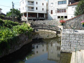
Percurso pela Ribeira de Santa Comba Dão
- country
Ribeira de Santa Comba Dão
3440, Santa Comba Dão
A walkway located along the Santa Comba Dão River, it's a pleasant place for a leisurely stroll. Along the way, you'll spot ducks and colorful flowers.
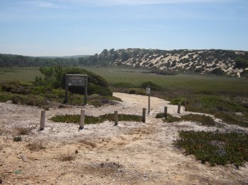
Percurso Pedestre do Barbarroxa de Baixo
- country
Monte Velho
7500, Santiago do Cacém
A long walking trail approximately 3.5 km long and lasting about three hours. It begins at Monte Velho beach, heading south along the Barbarroxa wells to Areias Brancas. It offers stunning views and a glimpse into the dynamics of a shifting dune.
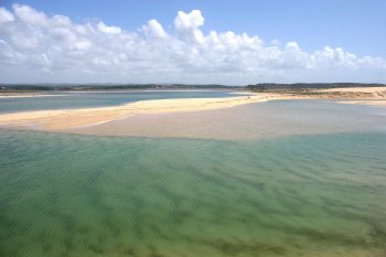
Reserva Natural das Lagoas de Santo André e Sancha
- country
Santo André
7500-110, Vila Nova de Santo André
A nature reserve since the beginning of the century, it includes the Santo André and Sancha lagoons, as well as a system of small freshwater lagoons formed in dune depressions. It extends along a 16-km coastal strip, including a terrestrial sector of varying width, ranging from 2 to 3 km, and a marine sector measuring 1.5 km. In total, the occupied area is 5,247 hectares, of which 3,110 hectares correspond to the terrestrial portion and 2,137 hectares correspond to the marine portion. This area is home to a variety of birds, including aquatic birds and passerines. It is also worth …
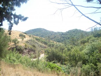
Serra do Caldeirão
- country
Serra do Caldeirão
8150, São Brás de Alportel
This mountain range is bordered to the north by the transition area to the Beja clay and pre-clay region, to the east by the Guadiana River, to the west by the Serra de Monchique, and to the south by the Barrocal Algarvio. It is therefore located in the central part of the Algarve, belonging to the Old Massif, in southern Portugal. The maximum altitude is 577 meters, reached at Pico do Mu, and its vegetation has characteristics typical of the Algarve region. It has very low population density, with a resident population of approximately 70,000.
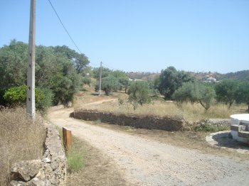
Percurso Pedestre da Fonte Férrea
- country
São Brás de Alportel
8150, São Brás de Alportel
This 2-kilometer hiking trail reaches a maximum altitude of 504 meters. After walking for 1 kilometer on a paved road, you'll find a dirt path on the right and enter the forest. These first few kilometers are relaxing, and hikers can enjoy a refreshing dip in the mineral water at one of the accessible springs along this trail and visit the remains of an ancient tomb.
Percurso Pedestre da Várzea da Cova
- country
Almargens
8150, São Brás de Alportel
This trail is located on the valley floor, along mule trails. It is 28 km long, allowing you to discover rural areas of extreme beauty and enjoying a unique microclimate.
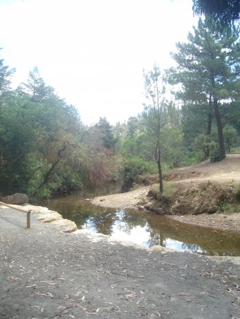
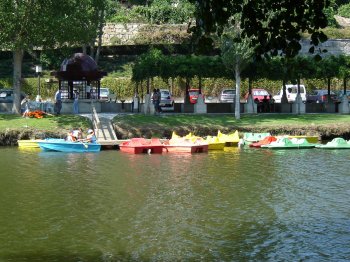
Passeio pelo Rio nas Termas de São Pedro do Sul
- country
Rua Principal
3660, Termas
Located next to the river beach, this space offers rowboats and pedal boats for a river cruise. A great way to spend an afternoon reconnecting with nature!
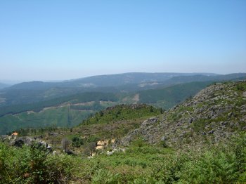
Área de Lazer de Alagoa
- country
Serra da Freita
3660, Serra da Freita
Leisure area located at the top of Serra da Freita, with picnic areas, clearly marked hiking trails and viewpoints with views of Serra da Arada and Serra da Gralheira, among others.
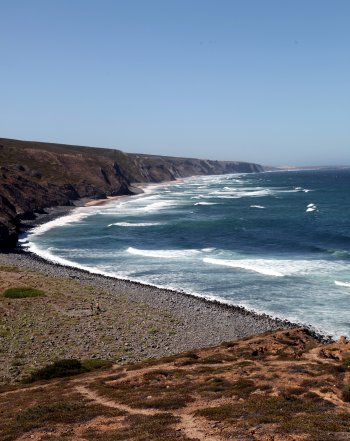
Parque Natural do Sudoeste Alentejano e Costa Vicentina
- country
São Torpes
7520-089, Sines
Between São Torpes and Burgau (Alentejo Coast and Western Algarve), the Southwest Alentejo and Vicentine Coast Natural Park encompasses the municipalities of Sines, Odemira, Aljezur, and Vila do Bispo, as well as a strip of sea approximately 2 kilometers long-running parallel to the coast. Expressions such as "sandy beaches," "rocky coastline," "cliffs and islets," and "veins of water flowing into the sea" used in the same sentence are synonymous with the Vicentine Coast and Southwest Alentejo.