Explore the best places
Results for Serra+da+Estrela in Portugal
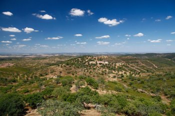
Serra de Monchique
- country
Serra de Monchique
8550, Fóia
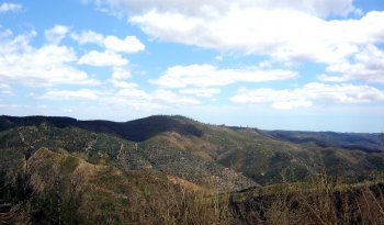
This mountain range belongs to the Antigo Massif , south of the Tagus and divides the Alentejo from the Algarve. It is located between the Espinhaço de Cão and Caldeirão mountains. It has a maximum altitude of 902 meters (reached in Foia) and measures 30 km in length.
Serra de Monfurado
- country
Serra de Monfurado
7050, Escoural
It is 17 km long and it is located to the south of Montemor-o-Novo, between the Canha and Alcáçovas Brooks. It has a wide diversity of plants.
Serra de Montemuro
- country
Serra de Montemuro
4690, Alhões
It lies between the Douro River to the north and the Paiva River to the south, bordering the city of Lamego. The highest point of the mountain range is called Montemuro, at 1,381 meters above sea level. The entire mountain range is quite steep and steep on practically all sides. The mountain range is populated up to approximately 1,100 meters above sea level, with villages scattered throughout, but almost always near watercourses. The Varosa River (which separates it from the Leomil Mountains) and the Balsemão River originate in this range. The Paiva River separates it from the Arada Mountains. It …
Serra de Montesinho
- country
Serra de Montesinho
5300, Montesinho
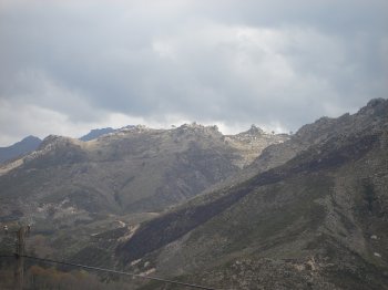
It belongs to the Ancient Massif of Trás-os-Montes, located to the North of Bragança, in the border with Spain. Part of the Natural Park of the Montesinho Mountain, this is where it reaches its tallest altitude: 1481 metres.One can take several pedestrian walks, mountain bike or drive a car along the rivers and getting acquainted with fauna and th fora of the region, as well as its typical villages and its archaeological vestiges.
Serra de Portel
- country
Serra de Portel
7220, Portel
Located on the southern edge of Central Alentejo, this mountain range features evergreen deciduous forests dominated by cork oak and holm oak groves. Here, we find a rich fauna, particularly in terms of birds and predatory mammals. Its maximum elevation is 420 meters.
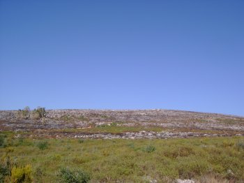
Serra de Sicó
- country
Serra de Sicó
3100, Vila Cã
This mountain range, at 553 meters altitude, belongs to the sedimentary edge of Estremadura, located east of Pombal. Situated east of Pombal, it divides the hydrographic basins of the Soure and Nabão rivers and measures 7.5 km in length. Its limestone formations contain an original set of caves, grottos, sinkholes, and escarpments. The vegetation at its base and on its slopes reveals cultivated fields of wheat and vegetables, pine forests, patches of oak groves, and a great variety of plants. It offers conditions suitable for climbing, paragliding, and various hiking trails.
Serra de São Luís
- country
Serra de São Luís
2950, Palmela
This mountain includes the Arrábida Mountain Natural Park. From its tallest point one can view the Setúbal Peninsula, Lisbon, the Atlantic Ocean and Tróia. It is a 2.5 km long massif, 1 km tall, with typical vegetation.
Serra de São Mamede
- country
Serra de São Mamede
7300, Portalegre
This hill comprises a part of the municipalities of Arronches, Castelo de Vide, Marvão and Portalegre. It is quite varied in geological terms, with diverse vegetation and a quite varied fauna. There are also many historical vestiges from the Paleolithic to the Middle Ages. It is the highest massif to the south of the Tagus river, with an area of 31750 hectares.
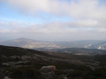
Serra do Alvão
- country
Serra do Alvão
5450, Pensalvos
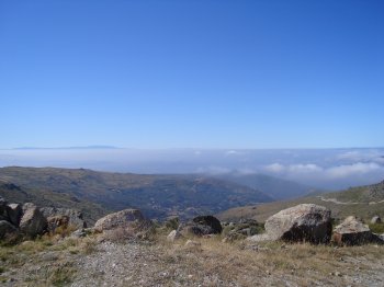
Integrated into the Alvão Natural Park, it is located west of Vila Pouca de Aguiar, in the northern extension of the Marão mountain range. It reaches a maximum altitude of 1,330 meters at the Cravelas geodetic vertex. Previously known as the Eiró mountain range, the Alvão mountain range is now also known by other names, such as the Ordem mountain range or the Sabugueiro mountain range, depending on the town. Characterized by its granite massif and pronounced plateau appearance, it has been occupied by humans since ancient times, notably the abundance of dolmens. It offers spectacular landscapes and beautiful pine …
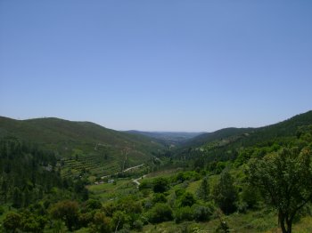
Serra do Gerês
- country
Serra do Gerês
4845, Vilar da Veiga
On the extreme north of Portugal, between the Cávado and Homem rivers valleys, in the Peneda-Gerês National Park, one finds the Gerês mountain that is 35 km long, 18 km wide, and reaches an altitude of 1507 metres. It is a water filled area and the richest mountain in the country, both in its flora and in its fauna. Of granitical nature, the mountain composes huge amphitheatres and incomparable sceneries. It also has cultural points of interest, namely due to its pre-historic vestiges.