Explore the best places
Results for Serra+da+Estrela in Portugal
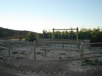
Parque Infantil de Arga de Baixo
- country
- leisure
Arga de Baixo
4910, Caminha
Children's playground with padded floor and diversions in wood and plastic, located in the middle of the Serra De Arga.
Barragem do Rio da Mula
- beach
- country
Alcabideche
2755, Alcabideche
This dam, located in the serra de Sintra, passes near the village of Cascais and flows directly into the sea.
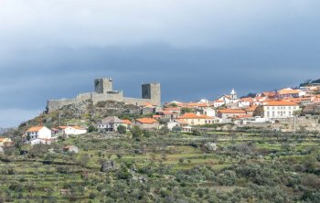
Linhares da Beira
- country
- heritage
Linhares da Beira
6360-080, Celorico da Beira
The village is located at an altitude of approximately 800 meters, at the foot of the Serra da Estrela mountain range, and its origins date back to 850 BC, during the occupation by the Turduli. Later, it was crossed by the Roman road that connected Emerita to Braga. Traces of sections of the Roman road and forum are still visible. The castle, a national monument, was built in 1291 during the reign of King Dinis and features two towers. In the parish church, erected in the 12th century, there are three paintings attributed to Grão Vasco, considered the landmark of …
Pico Gaspar
- country
EM 502
9700, Angra do Heroísmo
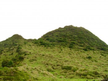
About peak of 597 meters of altitude, resulting from a secondary eruption of the Serra de Santa Bárbara. In its crater there is an authentic oasis of typical endemic plants Macronesian forest.
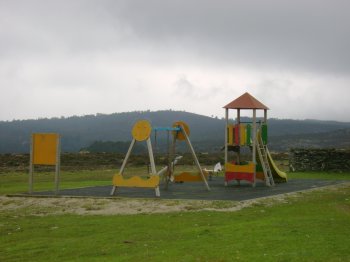
Parque Infantil de Silvares
- country
- leisure
Silvares
3465, Campo de Besteiros
Small playground situated on the slopes of the serra do Caramulo. The floor is sand has swings, a Bank and a container into the trash.
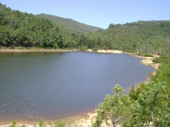
Lagoinha
- country
Serreta
9700, Angra do Heroísmo
Pond situated on the slopes of the Serra de Santa Bárbara, inside a volcanic cone. This is one of the ponds more virgins and of greater natural beauty of the island. Highlight is the richness of its fauna and flora.
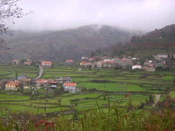
Germil
- country
- heritage
Germil
4980, Germil
A traditional village nestled between valleys and mountains in the fertile Serra Amarela region. It features traditional houses and stone sidewalks.
Lagoa Negra
- beach
- country
Calheta de Nesquim
9930, Lajes do Pico
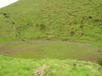
Small lagoon located inside the Serra de Santa Bárbara caldera, at 1021 meters above sea level, in an area of high rainfall. It is also within the area covered by the Site of Community Importance of Serra de Santa Bárbara and Pico Alto, where most types of natural ecosystems in the Azores are represented.
Meãs
- country
- heritage
Meãs
3320, Meãs
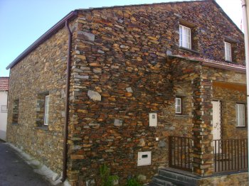
Located in the northeast of the municipality of Pampilhosa da Serra, on the right bank of the Unhais River, the village of Meãs is home to fewer than 200 inhabitants. The territory of which Meãs is a part predates the establishment of the nation, given the existence of numerous fortified settlements. The typical schist houses lend a distinctive color to this area. Also, noteworthy are the chapel tower and the small shrines.
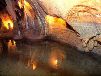
Grutas de Alvados
- country
Rua das Grutas
2480-034, Alvados
Discovered in 1964, they are found in the Serra de Minde, in an area where these formations are abundant. They have a gallery/chamber/well configuration. Notable features include stalactites, stalagmites, and illuminated lakes in the successive interconnected chambers.