Explore the best places
Results for Serra+da+Estrela in Portugal
Serra da Lapa
- country
Serra da Lapa
3640, Quintela
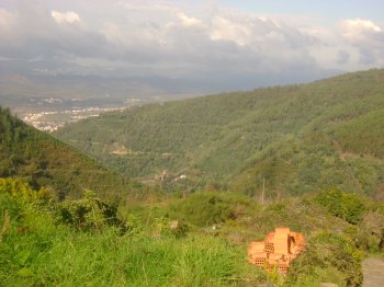
It belongs to the Old Massif of Entre Douro e Tejo and it is located to the northeast of the district of Viseu. It is 8 km long and 3 km wide and contains the spring of the Vouga river. Currently, in August, on the Shrine of Our Lady of Lapa, thre is a popular "romaria". It is an excellent belvedere.
Serra da Lousã
- country
Serra da Lousã
3200, Lousã
This mountain range is located between the Açor and Sicó mountains, southwest of Coimbra, on the border with the district of Leiria. It measures 30 kilometers long and 30 kilometers wide, reaching its highest point of about 1,000 meters at Alto do Trevim. It is a mountain range deeply furrowed by a branching network of valleys and steep slopes on its northwestern edge. It boasts a rich fauna and flora, boasting a wide variety of botanicals, and even some watercourses, the famous Lousã river pool. Along the mountain range, trails lead us to villages frozen in time, populated by schist …
Serra da Melriça
- country
Melriça
6110, Vila de Rei
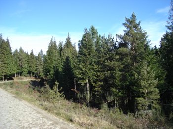
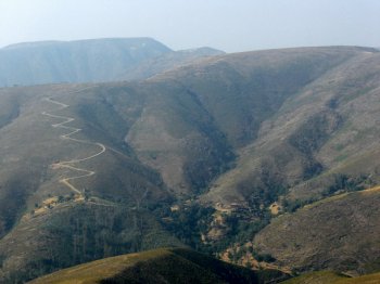
A hill located to the northeast of Vila de Rei, with a length of 10 kilometres and a height of 578 metres. Vila de Rei is the precise centre of the country and on the top there is a landmark, from 1802, that signals the local. That place has lovely panoramic views of the region. The space is filled with pine trees and there are traditional preserved villages, with thirs houses on the hillside and the streets paved with schist.
Serra da Padrela
- country
Serra da Padrela
5450, Vila Pouca de Aguiar
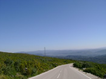
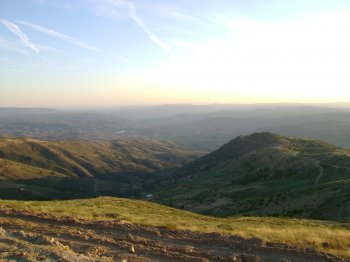
Located south of Chaves, between Valpaços and Vila Pouca de Aguiar, the mountain range is part of the Trás-os-Montes Ancient Massif and is 10 kilometers long. From the top, views over the entire region are enjoyed, with highlights including Oura, Vidago, and Vilarinho.
Serra das Talhadas
- country
Sobral Fernando
6150, Proença-a-Nova
This mountain range connects Alto Alentejo to Beira Baixa, stretching 27 km and measuring almost 2,500 m wide. Its slopes sometimes exceed 50%. It runs through Proença-a-Nova, Vila Velha de Ródão, and Nisa and is traversed by the deep epigenetic valleys of the Tagus and Ocreza rivers. Four geomonuments of the Naturtejo Geopark of the Southern Plateau can be seen in this mountain range.
Serra de Alvaiázere
- country
Alvaiázere
3250, Alvaiázere
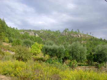
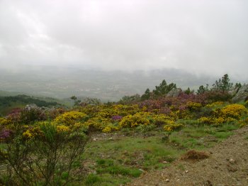
Limestone mountain with an altitude of 618 meters and a wide variety of fauna and flora. It belongs to the Sicó Massif, being the highest mountain range in this group. It is integrated into the Natura 2000 Network.
Serra de Arada
- country
Serra de Arada
3660, Candal
The Arada Hill partly divides the Paiva and Vouga river basins. It starts in Castro Daire and reaches its peak at São Pedro do Sul. It is 20 km long and 15 km wide. It has some villages lost in time, such as Drave.
Serra de Bornes
- country
Serra de Bornes
5350, Alfândega da Fé
A mountain range with a maximum altitude of 1,200 meters, located in the extension of the Montesinho mountain range. It's a good option for paragliders and hang gliders.
Serra de Bornes
- country
Serra de Bornes
5340, Olmos
It belongs to the Old Massif and is located in the east-central region of Trás-os-Montes, between the Sabor and Tua rivers. It is over 12 km long and 5 km wide, reaching its highest point at 1,200 meters, above the Vilariça valley. The region is characterized by mountain ranges, small high-altitude plateaus, deep, hollow valleys, some watercourses, and open valleys. The flora ranges from chestnut trees to cork oaks, olive trees, almond trees, cherry trees, orange trees, and vineyards. It is noteworthy that, until a few years ago, rye was cultivated at an altitude of about 1,000 meters.
Serra de Mairos
- country
Serra de Mairos
5400, Mairos
This hill, located on the border of Chaves, between the Mente and the Tamegão rivers, reaches its peak on the Cota de Mairos. In the village of Mairos the Buraco Feio (Ugly Holle) caves and the Câmara do Diabo (Devil's Chamber) are worth a visit.
