10 routes for a bike ride in the Douro
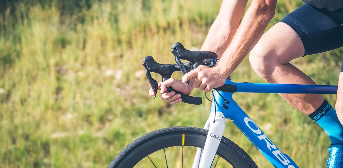

The Alto Douro Wine Region is a beautiful area and offers scenarios that are truly paradisiacal. Taking a bike ride in the Douro is an experience that promises to be unforgettable.
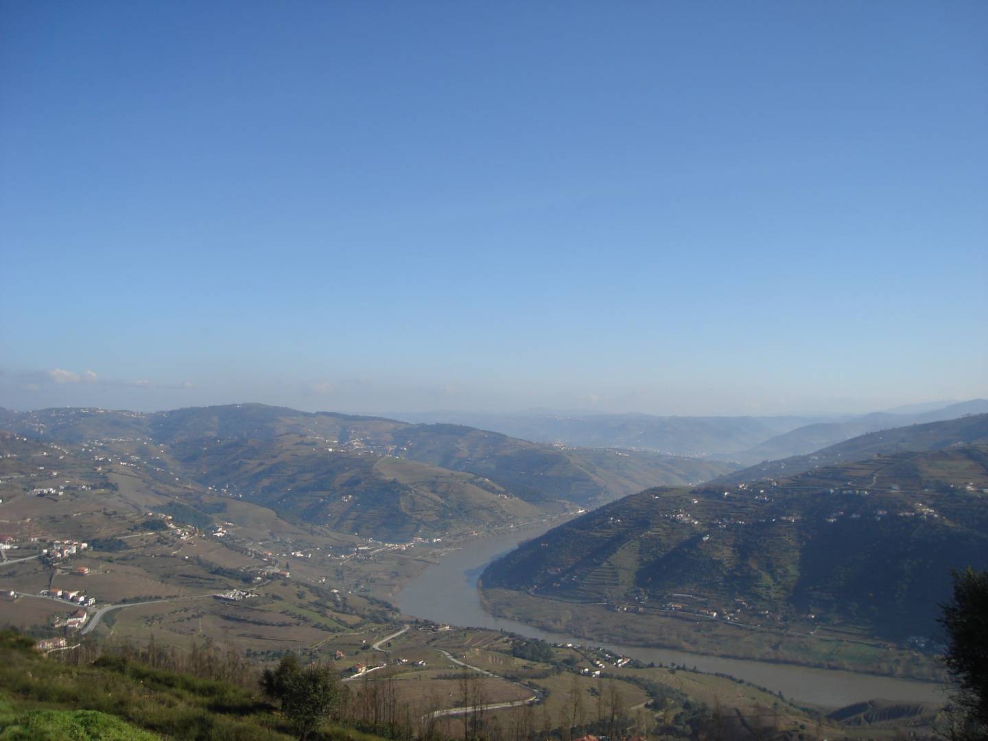
Strolling along vineyards or stopping at breath-taking viewpoints are unmissable experiences that you can have when taking a bike ride in the Douro region. Classified as a World Heritage Site by UNESCO, the Alto Douro Wine Region, located in the interior North of Portugal, offers truly stunning views, where terraced vineyards and the imposing Douro River stand out. All About Portugal shows you 10 routes to cycle in this vast region blessed by Nature, where sustainable and ecologically responsible tourism has been gaining ground. Some are short and easy to carry out, others are longer and more demanding from a physical point of view, but all these courses promise to make your day.
Vinhas Route, São João da Pesqueira
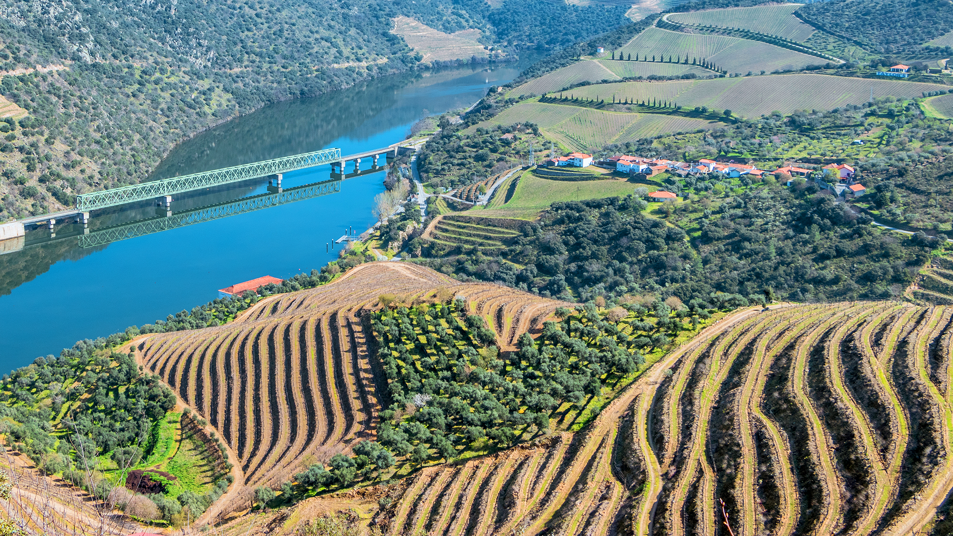
This route is fertile in amazing landscapes over the Douro River and the slopes of terraced vineyards that are the hallmark of the municipality of São João da Pesqueira, considered the “heart of the Douro Wine Region”, as it holds the largest classified area of that World Heritage site. Starting and arriving at the centre of the Parish Council of Ervedosa do Douro, the route is approximately 25 kilometres long and has a high level of difficulty. It is presented as a pedestrian route, but it is also an interesting bicycle ride in the Douro, being formed by two circuits that pass very close together. This route offers a magnificent scenery and an intense contact with nature, also conducive to the practice of hiking, birdwatching and sustainable tourism.
Walkway of Folgosa, Armamar
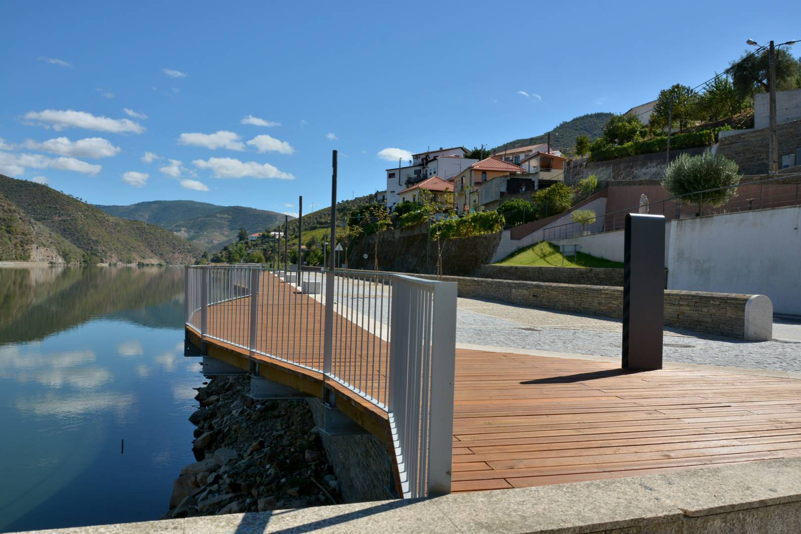
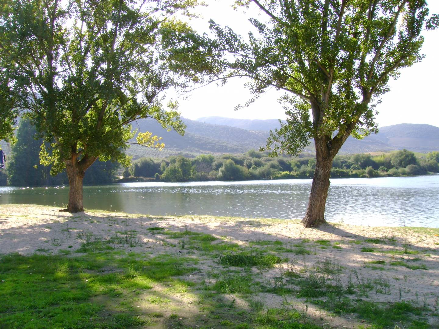
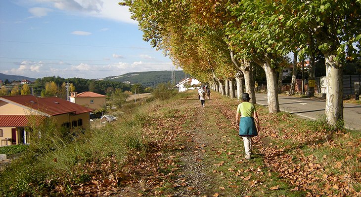
Also known as the Douro Eco-trail, this pleasant route is located right next to the Douro River, close to the tourist pier, and offers a remarkable landscape in which the water mirror merges with the terraces of the vineyards of some of the most important wine farms in the area. The walkway is a panoramic pedestrian path, which can also be covered by bicycle, and an outdoor leisure area. It was created as part of the work to consolidate the slope that supports the EN 222, considered to be one of the most beautiful roads in the world, and is approximately one kilometre long. It has fishing grounds, spaces for picnics and three “balconies”, where you can properly appreciate the magnificent scenery, as well as the tourist boats.
Riverside Greenway, Peso da Régua
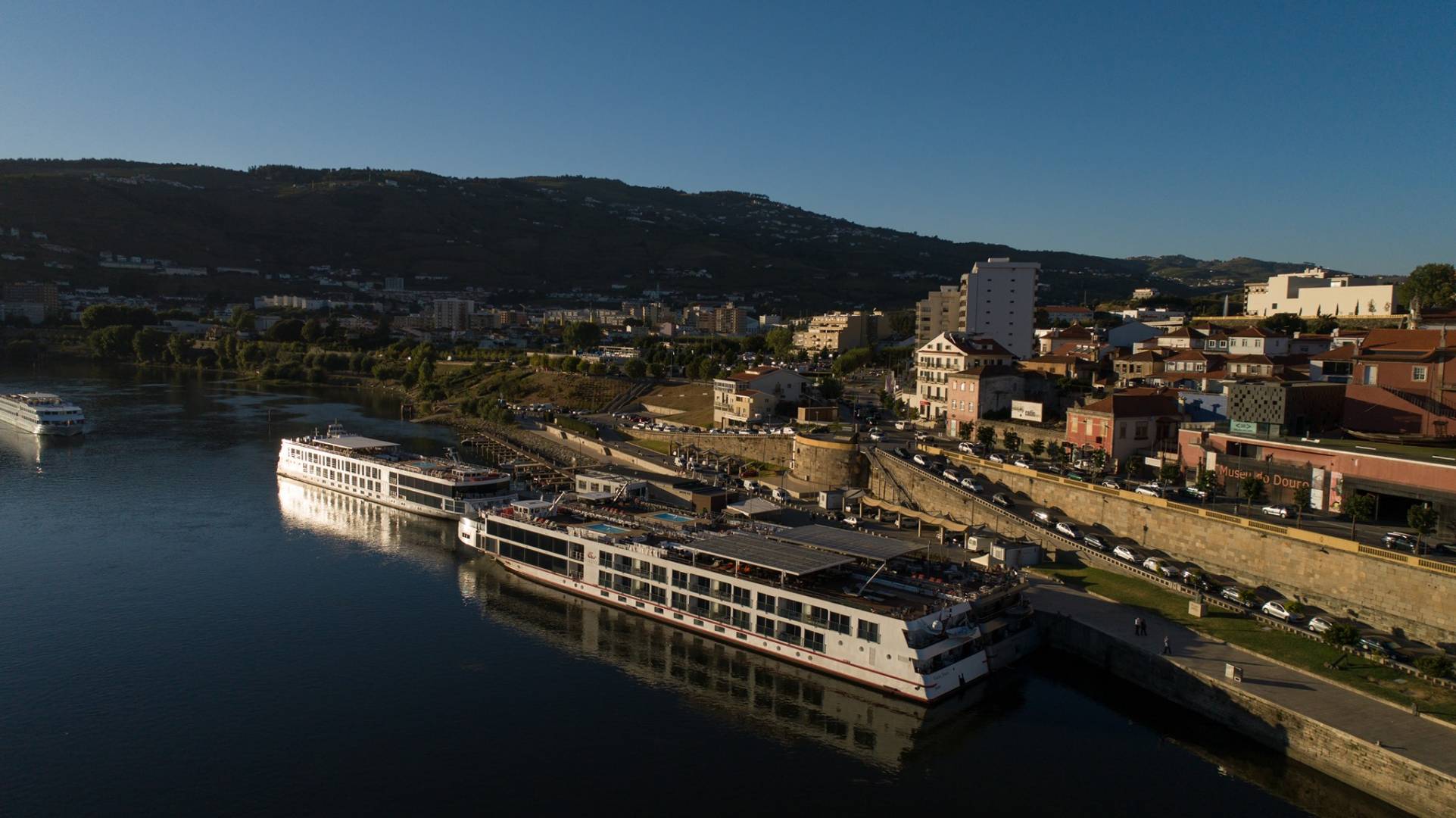
In the riverside area of Régua we find another magnificent setting in which cyclists and pedestrians can enjoy a journey of more than two kilometres, always in the company of the Douro River. This trail was created in the context of the “Frente Douro” urban regeneration operation and is an area of choice for enjoying nature and for practising sports. The floor is excellent, and this is also a privileged place for observing birds such as the heron, the black kite, and the wild duck, as well as amphibians such as the common midwife toad, the Iberian frog, and the Perez's frog. From the eco-trail, you can also appreciate the centenary Metallic Bridge and access the Douro Museum, where you can learn more about the cultural and natural heritage of the Douro Region.
Grand Route of the Côa Valley, Vila Nova de Foz Côa
Comprising 222 kilometres of trails, the Grand Route of the Côa Valley passes through Fóios (Sabugal), where we find the Côa River source, and connects it to the municipality of Vila Nova de Foz Côa, where the Côa meets the Douro river. The Côa Valley Archaeological Park and the Douro Wine Region are two of the highlights of the final part of this Grand Route, which perfectly combines Nature and Heritage. The third and final stage of this route connects the village of Quinta Nova, in the municipality of Pinhel, to the vicinity of the Côa Museum. Along its 62 kilometres, this demanding trail runs along forest paths, olive groves, almond groves, and vineyards. The Museum, located in the municipality that prides itself on being the only one to have two world heritage sites in Portugal, was built in a privileged location, at the confluence of the Douro and the Côa rivers. The view that its “balcony” offers over the two rivers and the fertile valley with terraced vineyards is simply sublime.
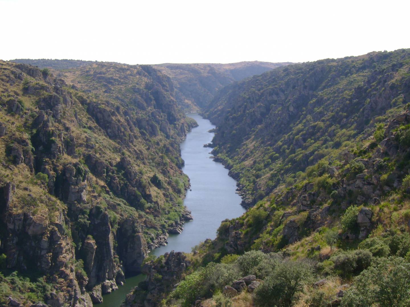
Figueira de Castelo Rodrigo - Barca d'Alva

Although not an “official” route, the section of the EN 221 that connects Figueira de Castelo Rodrigo to the riverside village of Barca d'Alva turns out to be a very pleasant and interesting bike ride in the Douro. The river pier of Barca d'Alva is the point that marks the limit of navigability of the Douro, where it meets the Águeda River. Test your bike's brakes carefully before hitting the road, as the final part of this 21 km route is a descent through landscapes to the Douro and the fertile slopes of olive groves, almond groves, and vineyards. In early spring, the so-called “almond blossoming” is the delight of those who pass through this area. A “mandatory” stopping point is the Alto da Sapinha viewpoint, where you can contemplate the striking landscape over the Douro River valley and all its inherent cultures.
Grand Route of the International Douro and Douro Wine Region, Freixo de Espada à Cinta
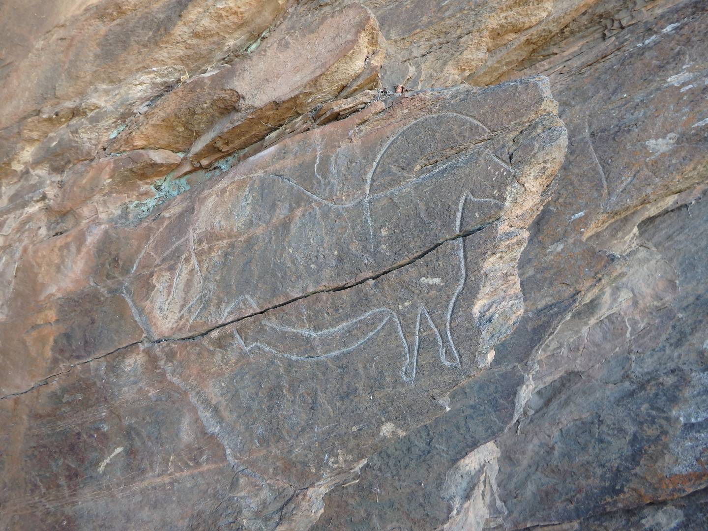
It is officially a pedestrian route, but there are some courageous people who cycle through it almost entirely. This long route is 176 kilometres long and crosses four municipalities, linking the cliffs of the Douro River to the vineyards of the Douro Wine Region, which provide impressive landscapes. Given its length, it is advisable to divide the route into several stages. This Grand Route starts in Paradela, Miranda do Douro, and crosses an area where the contrast between the steep valley of the Douro and the Mirandês Plateau is obvious. It then enters the municipality of Mogadouro, where there is an alternative section that takes place in the vicinity of the Douro valley. Next is the municipality of Freixo de Espada à Cinta, which has the longest extension of the route, of about 60 kilometres; one of its highlights is the passing through the village of Mazouco, known for its rock carvings. Finally, in Torre de Moncorvo, the route crosses the county seat and an area of the Demarcated Douro Region.
Sabor Greenway, Torre de Moncorvo
Among the suggestions for cycling in the Douro, we had to include this 34-kilometre eco-track that takes advantage of the reuse of the railway line, in the section between the north bank of the river, in Pocinho, Vila Nova de Foz Côa, and Carviçais, in Torre de Moncorvo. The route requires adequate physical preparation and offers ravishing views over the Douro River, the Sabor Valley, the Alto Douro Wine Region and the mountain range of Reboredo. It assumes itself as an infrastructure dedicated to recreation and, at the same time, as a way to rediscover landscapes of great beauty, “forgotten” since the deactivation of the railway line. The town of Foz do Sabor, known as the last fishing village in Trás-os-Montes, is the point where the Sabor River flows into the Douro, presenting a vast water mirror.
Miranda do Douro - São João das Arribas
The landscape seen from the São João das Arribas viewpoint is simply breathtaking, such is the immensity that it is possible for the eye to reach, as well as the “perfect” setting between the Douro valley and the rocky cliffs. This is the arrival point of this eight-kilometre route that starts at the tourist office in Miranda do Douro, a municipality that borders Spain. The route is, for the most part, flat, showing, however, some slight ascents and descents in the Mirandês Plateau, in full communion with Nature. The route passes through the villages of Vale de Águia and Aldeia Nova until reaching the unpaved path that leads to the chapel of São João das Arribas, located in a point overlooking the Douro valley and whose surroundings constitute one of the most enigmatic viewpoints in the Natural Park of Douro International.
Route of Pico da Vila, Mesão Frio
Another excellent suggestion for a bike tour in the Douro that requires some physical preparation. This 12 km “circuit” crosses hills, vineyards, villages, and ancestral paths, often with a privileged view over the river. The route has a lot of ups and downs, and one of the characteristics that makes it so interesting is the “triad” between hills, vineyards, and the Douro. The Largo da Independência, located in the centre of the town of Mesão Frio, serves as a starting and ending point, and the passage through the São Silvestre viewpoint, from where you can admire an enchanting landscape over the river and vineyards, is one of the most appreciated points.
Corgo Greenway, Torre de Moncorvo
As a result of the restoration of the old railway line deactivated in 1990, and which joined Vila Real to Vila Pouca de Aguiar, the Corgo Greenway is an eco-trail that allows you to enjoy a magnificent landscape over the Marão and Alvão mountain ranges and several water lines. This panoramic route with leisure areas presents great wealth in terms of flora and fauna and can also be done on foot or on horseback. In the municipality of Vila Pouca de Aguiar, the trail is 20 kilometres long, starting at Tourenzinho, passing through the spa town of Pedras Salgadas and ending in Sabroso de Aguiar. In the area of the Vila Real municipality, the route is 18 kilometres long, starting at the former trail station and going close to the limits of the neighbouring municipality.
Recommended